Assistance for Hurricane Harvey Responders
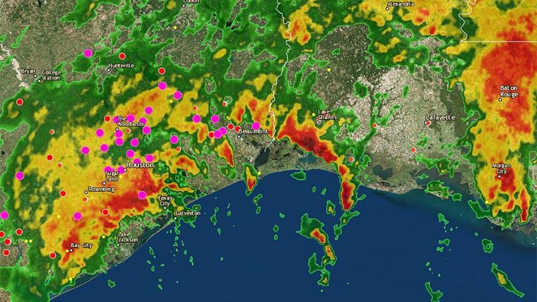
Esri is working with responders to prepare them in their work with hurricane Harvey that is striking the south coast of Texas, USA. Support provided consists of software, data, imagery, project services and technical support. Examples are constantly updated hurricane information showing the projected paths, storm surges, weather warnings and precipitation, as well as real-time posts with imagery and videos on social media.
It’s thus possible to consult the Tropical Storm Harvey map and track the current situation, warnings, traffic situation and road closures, rain forecasts and more. Also crowdsourced imagery is available – the images provided will be located on the map and this create an impression that is helpful for first responders.
There is also a range of web applications available mapping aspects of the disaster following the Tropical Storm Harvey as well as anticipating future situations.

Value staying current with geomatics?
Stay on the map with our expertly curated newsletters.
We provide educational insights, industry updates, and inspiring stories to help you learn, grow, and reach your full potential in your field. Don't miss out - subscribe today and ensure you're always informed, educated, and inspired.
Choose your newsletter(s)


