Emergency Mapping Gets HOT
Paul Stewart explains how the Humanitarian OpenStreetMap Team applies the principles of open source and open data for economic development, disaster preparedness and emergency relief around the world.
Non-for-profit humanitarian organization HOT is a global online community of volunteer digital humanitarians, who apply the principles of open source and open data to create and provide free, detailed and up-to-date maps for NGOs and local communities fostering economic development, enhancing disaster preparedness and engaged in emergency relief.
The organization’s objectives are to provide remote data creation during humanitarian crises, to connect open mapping communities with humanitarian actors, to support deployments to the field and to develop open knowledge and tools; objectives which are realised by harnessing the organization’s global community, open source software and the spirit of collaboration.
Crisis Mapping
Humanitarian crises necessitate the fast and effective use and sharing of geographic data. The “where” dimension is of crucial importance because aid in the wrong place is no aid at all. Director of Save the Children International Charlie Mason echoes the thoughts of thousands first responders when she states, “in an emergency we want maps, maps of the affected population, displacements, major routes, other actors, clinics, water points and so on, all the things [we] need... to plan and coordinate the response.” Very much aware of this, HOT rapidly and collaboratively creates and provides free, detailed and up-to-date maps which help first responders to reach those most in need.
HOT, as its name suggests, creates and provides these maps through OpenStreetMap (OSM) – the free street-level map of the world which can be edited with specific editing software (the desktop editor JOSM, the default in-browser iD editor and many others for mobile devices and just about any operating system) and a base layer of satellite imagery over which the editor traces. HOT has developed a piece of software called the OSM Tasking Manager which introduces a mapping project, explains what needs mapping, divides the mapping project into small mappable squares, facilitates the distribution of these squares and links to the abovementioned editing options.
When disaster strikes or a crises arises, the HOT activation leadership waste no time in ascertaining the scale and impact of the event, finding what OSM data already exists and what satellite imagery is available. This information informs an appropriate response. It informs what needs to be mapped; if it can be mapped and to what geographical extent it should be mapped.
Once the mapping project is created in the tasking manager and the call is put out via the HOT mailing list, the global online community of digital humanitarians mobilizes and does not rest until every square metre that needs to be mapped is mapped, validated and put into the hands of the first responders. These efforts are most often augmented by ground teams that put names to streets and buildings and locate essential amenities such as schools, health facilities and ATM machines.
In response to last year’s Nepal earthquake, HOT boosted OSM coverage of Kathmandu and its surroundings by mapping roads, buildings, waterways, residential areas and internally displaced people (IDP) camps. In partnership with Kathmandu Living Labs (KLL), who, among many other things, gathered a wealth of locally submitted crisis data using the Ushahidi (Swahili for witness) map-based crowdsourcing platform, HOT supported numerous NGOs’ emergency relief efforts. The two figures on the left show central Kathmandu on OSM before and after HOT’s crisis mapping. Note the incredible amount of spatial data first responders had at their fingertips after HOT’s crisis mapping. Note the incredible amount of spatial data first responders could use to plan and coordinate their emergency relief efforts.
Working in Partnership
It is mapping projects with a long-term focus, foster economic development, enhance disaster preparedness and help a host of NGOs perform their day-to-day work, which constitute the day-to-day work of HOT. And it is the Missing Maps project – a collaborative humanitarian mapping project founded in 2014 by HOT, Médecins Sans Frontièrs (MSF)/Doctors Without Borders (MSF-UK), the British Red Cross and the American Red Cross – from which the majority of this work stems. Right now, Missing Maps partners are, on request and beyond busy, mapping areas of Guyana, Belize, Zimbabwe, Swaziland and many more countries for the Missing Maps project.
The Missing Maps project’s aim is to “[put] the world’s vulnerable on the map”; to create base maps of the world’s most vulnerable locales with which NGOs can plan and coordinate programmes which aim to address these locale’s most pressing problems. It is achieving its aim thanks largely to remote volunteers who trace satellite imagery into OSM and local volunteers who add local details such as street names, place names and the most essential local amenities.
Of course, the world’s most vulnerable locales have been mapped previously. However, what is in some cases, missing, is quality spatial data at the household/local community level. The spatial data being created as a result of the project is proving instantly and immeasurably valuable. The partner NGOs are using it to perform spatial epidemiology (analysis of disease and its geographic variations) and ultimately improve their response to outbreaks of diseases such as cholera, Ebola and malaria. The partner NGOs and several others are using it to plan and coordinate disaster risk reduction programmes. As with all data created by HOT, and in the spirit of collaboration, it is free and open to anyone wishing to use it.
Supporting Local Communities
HOT does not only collaborate with world-renowned NGOs. It also collaborates with local communities. Creating their own maps to foster economic development and enhance disaster preparedness; these local communities are also creating local capacities which allow them to take charge of their own development – the very essence of bottom-up development.
In Uganda, HOT is currently involved in a six month pilot programme supported by the Bill & Melinda Gates Foundation in developing a spatial data collection methodology which is accurate, inexpensive and integrates seamlessly into existing processes. The pilot programme is highlighting the cost and effectiveness of involving local community members in data collection and equipping data collectors with the required skills and equipment.
The pilot programme is also mapping financial inclusion. Financial inclusion is a prerequisite for prosperity, stability and resilience, and, with the advent of digital financial services and the emergence of mobile money agents, it is now a genuine possibility for even the poorest. It is, however, only a possibility. Rapidly growing numbers of financial service locations demand sophisticated, real-time location and analysis tools. Without such tools, banks and telephone companies are unable to expand their network of locations in a way that includes all. And this is where the pilot programme comes in. While existing spatial data collection methodology revolves around periodic national surveys which are cost-prohibitive and that pose sustainability challenges, the spatial data collection methodology being developed by the pilot programme incorporates real-time location and analysis tools. The pilot programme’s local community led mapping is already allowing service providers to identify gaps in coverage and prioritise their filling.
Developing Open Source Software
HOT also develops open source software to assist collaborative mapping. Most recently off the conveyor belt is the Humanitarian Innovation Fund (HIF)-funded OpenAerialMap (OAM). The first of its kind, OAM is a free and open platform for processing and providing Earth imagery for disaster preparedness and emergency relief.
OAM was first conceived in 2007 when imagery providers began making their data freely available for crisis mapping. From the outset, it was clear the crisis mapping community was struggling to digest and organize the surge of information. It took several years of brainstorming and prototyping to finalize the design HOT proposed to HIF; a design which included a set of open source tools for providing the necessary Earth imagery uploading, hosting, sharing, searching, filtering, displaying, downloading and using functions.
The OAM platform was eventually developed in collaboration with Development Seed who utilized their experience designing mapping user interfaces and developing open source tools to build an attractive and effective catalogue application. The application consists of an interactive, easy-to-use world map browser presented with a dynamically shaded grid that symbolizes density and availability of images. Users can navigate the map and click on any cell to display footprints, overviews and details of each image.
OAM is already being utilized. To give just two examples, the UAV Humanitarian Network (UAViators) is utilizing it to share imagery collected by drones flying over areas affected by natural disaster and the World Bank-sponsored Ramani Huria project is utilizing it to support its disaster risk reduction work.
Get Involved
HOT’s work relies almost exclusively upon its skilled and dedicated volunteers. Volunteer mappers, volunteer validators, volunteer fundraisers. The list goes on. And it is always seeking new volunteers, volunteers just like you! Go to https://hotosm.org/
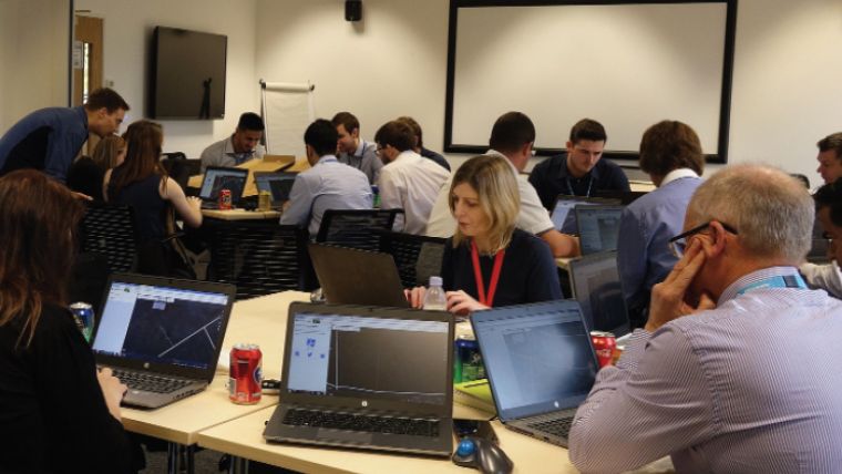
A HOT Mapping Party
There are many ways in which you can get involved. Firstly, you can join the HOT mailing list. On joining the HOT mailing list, you are instantaneously connected to the entire, helpful and approachable HOT community and instantaneously party to countless vibrant discussions on all things HOT. Secondly and perhaps most excitingly, you can map (either remotely or at a mapping party like the one pictured above). Create an OSM account, use the training materials at LearnOSM.org and make haste to HOT’s OSM Tasking Manager which, as explained above, introduces ongoing mapping projects, explains what needs mapping, divides and distributes mapping projects and links to the different editing options. Even if you have no cartographic experience, in no time at all, you could be supporting Peace Corps’ Botswana public health programme, Missing Maps’ West Swaziland malaria elimination programme or MSF’s provision of aid in Tete Province, Mozambique. Thirdly, you can join a HOT working group. There are eight HOT working groups: activation, communications, community, fundraising, governance, security, technical and training. Each call for skills other than those associated with mapping. All of them are driving HOT into the future. Finally, if you do not have the time, but would like to help, you can donate at hotosm.org/donate.
A Global Footprint
Sometimes, it is nice to zoom out and see what all this work amounts to. So, to end, here is HOT’s quite remarkable global footprint: 120 million edits; 1 000 projects; 165 000 volunteer hours.
This article was published in GIS Professional April 2016

Value staying current with geomatics?
Stay on the map with our expertly curated newsletters.
We provide educational insights, industry updates, and inspiring stories to help you learn, grow, and reach your full potential in your field. Don't miss out - subscribe today and ensure you're always informed, educated, and inspired.
Choose your newsletter(s)


