Geospatial, IoT and the Digital Twin
The IoT phenomenon, although still in its infancy, has revolutionised almost every sector in today's world. Among the many buzzwords associated with the field is one known as the 'Digital Twin'.
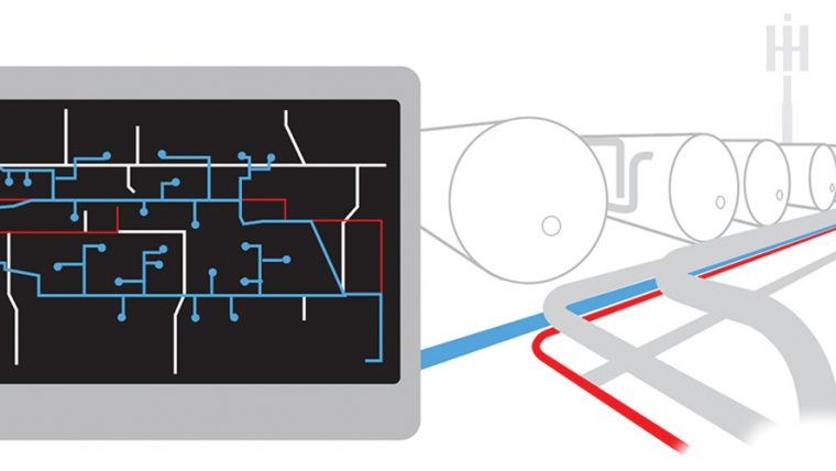
The Digital Twin concept refers to a means by which industrial machinery, buildings, devices and their component parts are designed, engineered, monitored and maintained both physically and digitally. Essentially, the Digital Twin is a virtual representation of an asset, and it's based on the rationale that one can better understand how it operates and interacts with the surrounding world through designing an exact replica.
The Benefit of Digital Twins
The Digital Twin is revolutionising many industries across the world - especially the utilities sector - and the industrial internet is being embraced by service engineer managers because of the benefits it provides. From the perspective of engineering, maintenance and management of utility assets, the Digital Twin allows engineers to gain a better insight into the operational performance of the asset in real-time. The key benefits of the above being that Digital Twins help to improve operational reliability and availability, minimise costs, reduce unscheduled downtime, and reduce operational risk. By 2021, digital grid technology is expected to deliver almost US$19b in cost savings worldwide - mostly through reduced energy use and avoided emission costs. ('Smart cities – on the faster track to success', Juniper Research, 2016.)
A Map isn’t a Digital Twin
A typical GIS map of a utility network is not a Digital Twin. Although it may consist of accurate locations and attributes of the network features, it's still merely a representation of the network. The data used in the GIS system is very often out of date moments after it is captured, meaning that it is not a true reflection of reality. As a result, asset managers are unable to make definitive assessments and informed decisions without first consulting site-based inspectors and relevant blueprints or scans.
That said, providing locational context is where the geospatial world is beginning to augment the world of IoT. Geospatial information helps the Digital Twin to become aware of both the actual and relative position of its real-world counterpart - i.e. where the asset was/is in relation to its surroundings and the environmental conditions (e.g. flat or hilly terrain, hot or cold climates, safe or dangerous locations) in which it lives.
Naturally, this is where GIS is beginning to converge with systems such as Building Information Management Systems (BIM) software. While one is generally focused on what is inside and the other on what is outside, both systems are becoming inextricably linked throughout the industrial internet lifecycle. Government-driven mandates, requiring the capture of asset data also require that certain materials and assets be restricted to specific geographic locations. Geospatial data, such as boundaries, land parcels, built surroundings and environmental data help to provide a digital context into which an asset's Digital Twin can be born.
Creating Digital Twins would be impossible if it were not for the increasing availability of sensors, image capture and analysis technology, as well as powerful data transfer and cloud-based processing capabilities. As an example, some utility network Digital Twins can be continually updated and refreshed with data from LiDAR and other sources, while in cities such as Singapore and Manchester, Smart City initiatives are helping to create real-time urban digital representations.
Next Phases of the Digital Twin
Even at this early stage, the Digital Twin technological era is advancing rapidly. The OGC's OpenSensorWeb, open source software platform for location-aware sensors is helping IoT innovators to augment their technologies with real-time location information. Meanwhile, other powerful technologies such as GeoMesa (described on its website as "an open-source, distributed, spatio-temporal database built on a number of distributed cloud data storage systems") is allowing users to combine sensors and systems, such as GeoServer and Google Cloud Big Table, to powerful effect.
The Cognitive Digital Twin
Perhaps the most exciting phase in the Digital Twin IoT era however is the Cognitive Digital Twin concept. Essentially, this is an artificially intelligent Digital Twin which serves as an 'autonomous maintenance engineer'. Perhaps due to a feeling of sibling rivalry, the Cognitive Digital Twin is highly self-conscious - it 'thinks' about the information which it receives, it makes its own performance-focused decisions, it learns from past errors, and it is therefore continuously self-improving. Welcome to the Geospatial IoT era.
This article was published in GIS Professional June 2017

Value staying current with geomatics?
Stay on the map with our expertly curated newsletters.
We provide educational insights, industry updates, and inspiring stories to help you learn, grow, and reach your full potential in your field. Don't miss out - subscribe today and ensure you're always informed, educated, and inspired.
Choose your newsletter(s)


