Interactive Map Shows Fire with Address Search and Satellite Imagery
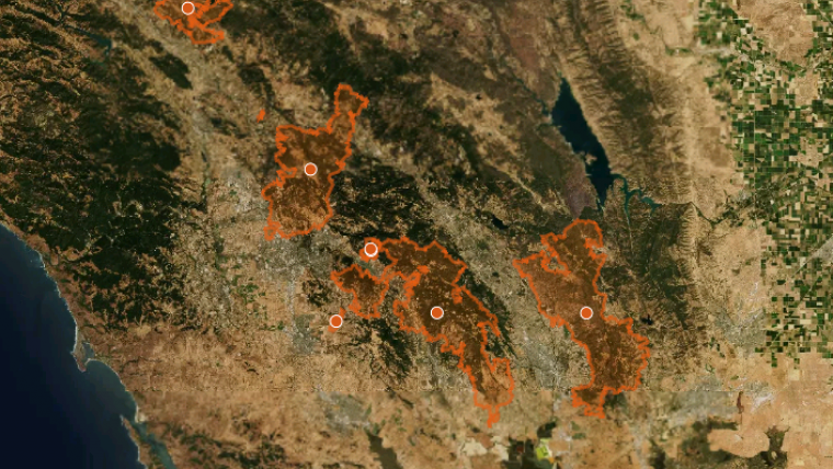
Mapbox has published a map to give people affected by the wildfires in Northern California and across the U.S. access to the most up to date information on fire perimeters in relation to specific locations and addresses.
Using the best available data coming from Geospatial Multi-Agency Coordination and from the agencies and first responders on the ground, this map allows anyone to search a specific address to see where it falls in relation to the fire perimeters for wildfires burning across the United States. Coupled with up to date satellite imagery from Digital Globe as part of their Open Data Program, this tool can provide valuable information to help those affected by fires get information about their family, friends, homes, and businesses.
The map is is an informational tool only and Mapbox cannot guarantee the data accuracy of an actively burning fire. Users are requested to refer to the legend and take note of date and time stamps both for the latest satellite imagery and fire perimeter information provided on this map, as they are delivered from separate data sources. Currently, the imagery layer shows the newest data on top. You may see seams between images, where collections overlap. Data will be updated as quickly as it can be processed for publication.

Value staying current with geomatics?
Stay on the map with our expertly curated newsletters.
We provide educational insights, industry updates, and inspiring stories to help you learn, grow, and reach your full potential in your field. Don't miss out - subscribe today and ensure you're always informed, educated, and inspired.
Choose your newsletter(s)


