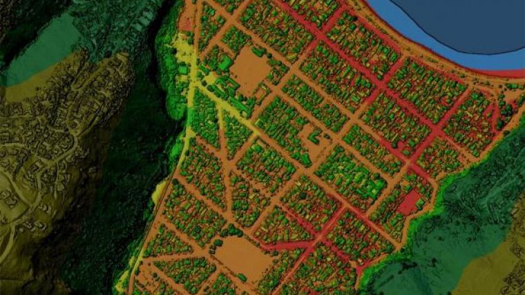
LINZ support for 3D Mapping of Northland
LINZ is partnering in a project to map Northland using Lidar – a method for collecting 3D data on our land and its features. Uses for Lidar data include flood risk assessment, urban planning, forestry and precision agriculture. Improved elevation data is major contributor to LINZ strategic initiatives to improve resilience to natural events and increase the use of geographic information.
LINZ is also working with local government to ensure that New Zealand’s Lidar data is collected at a consistent standard and is made freely available on the LINZ Data Service (LDS). Northland data will be collected to this standard and will be shared on the LDS.
The data will provide authorities with more confidence to progress infrastructure projects and deliver better, more cost-effective planning and a better understanding and ability to plan for sustainable land management. Forestry companies can improve their logging operations, horticulture companies their sustainable land management and public and private operators can better plan pest control.
The project is being funded by the government’s Regional Growth Programme and four Northland as well as LINZ.

Value staying current with geomatics?
Stay on the map with our expertly curated newsletters.
We provide educational insights, industry updates, and inspiring stories to help you learn, grow, and reach your full potential in your field. Don't miss out - subscribe today and ensure you're always informed, educated, and inspired.
Choose your newsletter(s)


