MAPSearch Launches ENvision Solar
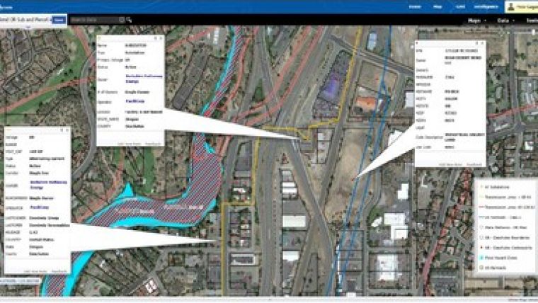
MAPSearch has launched their online mapping platform ENvision which enables users to locate, display, and analyse energy infrastructure using the same data licensed to their GIS customers. The platform is customisable and its assets can be searched, sorted, and displayed according to numerous details, including owner, operator, voltage and more.
According to Shawn McCarthy, vice president and general manager of MAPSearch, this platform brings together electric power infrastructure, wetlands data, parcel data, flood zones and a solar resources basemap for a comprehensive view of the US marketplace.
ENvision Solar Attribute Data includes:
- Full MAPSearch datasets
- Electric transmission lines coverage—for US/North America
- Substations coverage—for US/North America
- Power plants—for US/North America
- Service territories—for US investor-owned utilities and public power entities
- Parcel data—for more than 3,000 US counties and 140 million parcels
- Wetlands data—for US
- FEMA flood hazard zones—for US
- Solar resources basemap
- More than 20 basemaps to choose from
MAPSearch has been serving the GIS, oil & gas, and electric power communities for more than 30 years.

Value staying current with geomatics?
Stay on the map with our expertly curated newsletters.
We provide educational insights, industry updates, and inspiring stories to help you learn, grow, and reach your full potential in your field. Don't miss out - subscribe today and ensure you're always informed, educated, and inspired.
Choose your newsletter(s)