Sefton Council Uses GIS to Support ‘One Council’ Policy
One of the roles of the technical services team at Sefton Council, UK, is to support the Planning & Building Control department. This ranges from managing data used by planning officers on a day-today basis to producing evidence based work to assist the policy team. This where Geographic Information System (GIS) comes into play. By overlaying planning history, local plan data and policy data into web mapping, information can be shared across council departments and directly with the public.
The web mapping system at Sefton Council was no longer supported by its supplier. It was increasingly difficult to manage and import new datasets while supplying information from one department to another was becoming time-consuming. Data and information needed to be centralised, easier to manage and more effortless for the entire council and public to access. With Sefton Council’s deployment of an overarching ‘One Council’ policy, it had a requirement for a GIS that enabled open methods for data sharing.
Added Functionality and Data Details
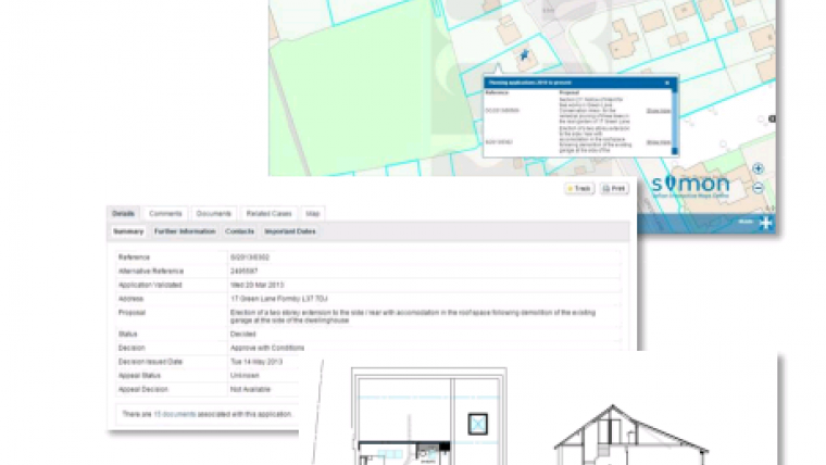
Sefton Council selected Cadcorp GeognoSIS as their GIS server, and Cadcorp SIS Desktop for administrative tasks. The council uses Cadcorp Web Map Layers as their public-facing application together with the standalone web service Local Knowledge. The council badged the resultant system SIMON (Sefton Interactive Maps Online). A SIMON+ version was added to give council staff more functionality, access to more datasets and more detail about those datasets where appropriate.
Address and location information from council departments dealing with planning, local land charge searches, environmental protection and road adoption is centralised and more readily available through SIMON. Council staff in the public-facing Contact Centre, as well as the public themselves, can be more self-sufficient and access this information directly.
Citizens Self Service
Chris Nelson, technical officer at Sefton Council commented that the Local Knowledge service offers ‘where’s my nearest school’ or ‘who are my councillors’ and ‘am I in a conservation area’. The information is there at the click of a button and saves the council a lot of time and money in terms of response by allowing citizens to self-serve.
The scope of SIMON is already expanding and will soon be utilised as part of a Brown Field Land Register to show exactly where each site is, and its relationship to local facilities. In addition, the internal SIMON+ system will soon be used to manage parks and gardens across Sefton Council and is being considered as a tool for analysing anti-social incident data.

Value staying current with geomatics?
Stay on the map with our expertly curated newsletters.
We provide educational insights, industry updates, and inspiring stories to help you learn, grow, and reach your full potential in your field. Don't miss out - subscribe today and ensure you're always informed, educated, and inspired.
Choose your newsletter(s)


