Lively Agenda in a Busy Day - AGI Scotland 2016
A trip north for GIS Professional's editor found him immersed in a different culture where even the units of measurement can be different.
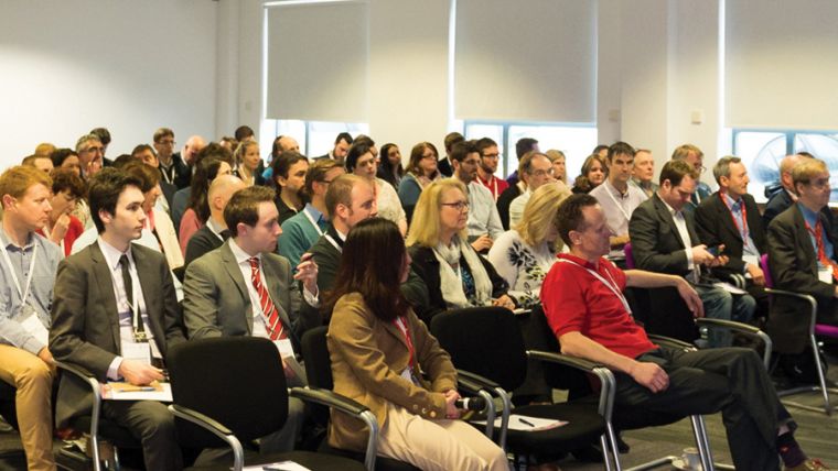
AGI Scotland’s annual conference was a reminder that they do some things differently there. This was an interesting and busy day in Edinburgh of mainly short lively presentations, debates and networking that attracted some 160 people. After a scene-setting introduction by AGI Scotland Chair Prof Bruce Gittings, we were off on the first of two keynotes.
North of the border, local government is guided and informed by the Improvement Service, an organisation to help councils improve the health, quality of life and opportunities of all people in Scotland through community leadership, strong local governance and the delivery of high quality, efficient local services. They do this through a range of support services such as training, research, analytics and advice, but critical is giving councils the capacity and the evidence base for rigorous self-assessment of services.
Colin Mair, who is chief executive, gave an alarming keynote that set out the challenges his organisation faces. A 14% budget cut in ‘real terms’ by 2020/21 for local authorities and a future of an ageing population and a flat-lining working-age population means a permanent gap between demand and income. Meanwhile, despite an ageing population, councils are no longer building bungalows for the elderly; such dwellings as they do manage are small three-bedroom dwellings with tiny bedrooms.
So how can geospatial help? ‘Openness around data is very important’ argues Mair. ‘Stats and charts are only possible if spatial information is available’. But ward level data is not enough to identify deprivation: it is ‘only identifiable if you get down to 500-1000 population units’ he says. Open data and “hackathons” by local authorities help build capacity and are a “smart” use of resources. However, GI data needs to be better understood by decision-makers, he concludes.
Historic Opportunities
Diana Murray works for Historic Environment Scotland (HES), a public body formed from the merger of Historic Scotland and the Royal Commission on the Ancient & Historical Monuments of Scotland. She explained that her organisation (and its predecessors) were early adopters of GIS. This is just as well for if there’s little money for local councils in the age of austerity, the cupboard really is bare for heritage.
Diana explained how their relationship with the public had changed from a “gatekeeper approach to a two-way relationship that encourages volunteers who can upload citizen research from family histories such as photographs and personal recollections, initiatives like Britain from Above (www.britainfromabove.org.uk) and Canmore (https://canmore.org.uk), an online catalogue of more than 320,000 records and 1.3 million catalogue entries of Scotland’s archaeology, buildings, industrial and maritime heritage.
HES and its predecessor, like its England & Wales counterparts, has been helped by the national mapping agency’s constant recording of historic sites and through the One Scotland Mapping Agreement (OSMA) which is key to One Scotland: One Geography programme. The Agreement has been extended to the Scottish public sector and their partners without any additional costs. Today, with the arrival of technologies like lidar and multi-spectral imaging, archaeologists are gaining new insight into ground features like crop marks.
Data and the Wisdom of Crowds
Events like AGI Scotland would be impossible without support from the GI industry. It was therefore not surprising that space has to be made in the programme for the sponsors to have their say. Neil Benny of ThinkWhere believes that we’re drowning in data yet we sit in “data islands” which are too often unconnected. “Instead, we defend and don’t share”, he says. People are frightened of sharing because of IP issues such as OS’s restrictions and data protection. By way of showing our intrinsic belief in data and the wisdom or otherwise of crowds, he cited the mystical island of Hi-Brazil allegedly off the south-west coast of Ireland and first recorded on charts nearly 700 years ago. Despite our clear knowledge of Earth’s features (confirmed from space) people still try to add it to Google Earth.
GIS Design Principle #1 – it’s not about the map was the title of a presentation from Brad Fisher of Sopra Steria, a French consultancy operating within the public sector. Their speaker told us that “GI was just another techno stack we put into a solution”, which was probably not what delegates were expecting to hear.
After the keynotes, the day divided into two streams, which made it difficult for your reporter to decide which one to follow. I opted for some from each.
The Last 10% for Hands Off?
Mapping the Road Ahead: from GPS to HAD was a chance for TomTom’s Douglas Gilmour to tell us all about the challenges of driverless cars. HAD – highly automated driving is the next big step for those who see this as a highly desirable aim. “What does the next 20 years hold for navigation and how should mappers respond?” asked Gilmour. Today’s navigation systems are user-centric and are not just for vehicles but walkers too. Advanced driving assistance systems are now routinely fitted to vehicles but we have a way to go before ‘hands-off’ driving is possible.
HAD relies on public sector data collection and requires detailed 3D lane mapping of highways (an all too easy task for the scene shown in Gilmour’s background slide of a straight desert highway stretching to infinity).
Your reporter queried whether the 90/10 rule of life did not apply to research into driverless cars: we are 90% there but we’ve spent only 10% of the time. The next leap forward is likely to depend on image detection and processing algorithms and data structure and stability. Technologies like DSRC (dynamic short-range communications) will also help through reduced in-vehicle computation.
As another questioner observed, “the low-hanging fruit has already been picked”. The final two steps are the most difficult. Full automation will mean capturing everything and dealing with situations that rely on eye-to-eye contact between drivers. Good luck with getting a computer to do that.
Space, Apps and a Dashboard of Insightful Analytics
Sam Campbell of Sterling Geo (now part of the burgeoning Hexagon Geospatial empire) told us all about the harnessing space technology to deliver business information. Backed by SSGP (the space for smarter government programme), Campbell believes there remains a gap between satellite data and awareness of what it can be used for. “Remote sensing remains in a windowless room” he observed.
With the nature of topographic mapping changing towards real-time, is a new paradigm emerging, driven by the cloud, analytics, pricing and smart maps? Sterling Geo’s response in conjunction with Hexagon is Smart M.Apps, a series of targeted, information services combining geospatial content and workflows for an interactive experience that includes the map and a dashboard of insightful analytics.
A Game Changer for Africa
Recent Airborne Lidar Innovations was an interesting presentation for Prof Iain Woodhouse. He’s been using mini lidar systems aboard UAVs for forest canopy monitoring. He sees the technology as a “game changer” for Africa where, thanks to carbon trading, forests are at last being seen as more valuable alive than dead!
There are currently two suppliers of miniature lidars: Riegl and YellowScan. The latter is lighter and cheaper than the Riegl and includes an IMU but does not have the same swathe capacity at around 2.1-metre point spacing. These lidars hold out the prospect of multi-spectral data gaining access to the under-story of the forest canopy and GNDVI - the Green Normalized Difference Vegetation Index (GNDVI), an index of plant “greenness” or photosynthetic activity – is one of the most commonly used vegetation indices to determine water and nitrogen uptake into the crop canopy.
Prof Woodhouse discussed the pros and cons of fixed-wing versus multi-rotor UAVs. Although the operational costs are much higher for fixed wing, productivity is much higher with areal costs as little as £1/hectare against £10/hectare for multi rotorcraft. The accompanying charts below show useful comparisons of the two lidars and fixed versus multi-rotors.
Why y is Irrelevant
Lunch was followed by a further sponsor session including four “Lightening” sessions from exhibitors. Ordnance Survey’s Rollo Home kicked off with “To boldly go. . . why is a national mapping agency interested in satellite-based technologies?” After a brief divergence for Trekkies into the Romulan neutral zone and the irrelevance of the y-axis in space, Home showed us a print of Ordnance Survey’s map of Mars (square and flat, none of this Earth 3D nonsense) before coming back to near-Earth to talk about how the mapping agency captures data from airborne platforms up to a height of 20kms, has a “scoping study” for driverless cars and the atomic timing of financial transactions. They can now relieve you of your money in nanoseconds, apparently.
It was something of a relief to get down to earth (well almost) with Paul Georgia of GeoGeo and the AGI’s Early Career Network. “Drone to Phone” was about maximising the geopotential with FOSS4G (Free and Open Source Software for Geospatial). This was an open source cloud solution as terabytes of data are involved from elevation data captured by a phone from which cross sections can be derived.
Next, it was the turn of Tom Whittome of Caledonian Air Surveys (see also GiSPro June 2015, Aerial Survey: bridging the gap) to talk about developments in photographic aerial survey or “flying a UAV with a pilot” as he described it. He reviewed the rapid changes that had taken place in this sector since 2005 when his company began operations. A busy market of some 1400 operators with a wide choice of cameras and sensors, software, GPS and IMUs has meant that aerial survey, once the province of specialist stereo plotters and analysers for ortho-rectification and mosaicing, can now all be done at the desktop for a fraction of the price.
Apps and Early Careers
“Developing a Crowd Sourcing App” heard from Tom Armitage of EDINA, the online GIS and mapping source for tools and apps hosted by the University of Edinburgh. Fieldtrip GB for students and researchers planning field trips is an app which can be shared across multiple devices via Dropbox. Add-ons enable soil sampling and biodiversity records.
The AGI Early Careers Network (ECN) is a recent initiative from the Association for Geographic Information to support university students as well as GI professionals with up to ten years experience. Mayuko Morgan said that a recent questionnaire found a 50-50 gender split for those entering or planning to join the industry; but 90% wanted more training (interestingly, the majority were ArcGIS users!).
To date, explained Mayuko, ECN has offered mock interview sessions, a buddy system and support for those opting for chartered geographer status. Future plans include establishing a set of hubs within larger geospatial employers.
Satellites the Final Frontier for the Clyde
My late father in law worked in John Brown’s shipyard on the great ocean liners like the Queen Mary, Queen Elizabeth and the QE2. Browns provided work for thousands, and along with Singer sewing machines was Clydebank. Today, the north bank of the Clyde is home to a range of high technology companies including one which designs and builds tiny earth observation satellites.
Formerly with Surrey Satellites, Craig Clark told us all about Tiny Spacecraft and disruptive earth observation. His company, Clyde Space is operating within one of the fastest growing sectors of the space industry. Smaller satellites, and we’re talking nano/micro vehicles up to 50kgs, mean faster into orbit and cheaper.
The demand for earth observation satellites has grown by a factor of three since 2009, according to Clark. His company’s answer is 3U, a satellite about the size of a whisky box (a unit of measurement in Scotland) which can carry three sensors offering 30-metre ground resolution. Up that to the 12U version (four whisky boxes?) and 1.3m resolution is possible. Glasgow’s CubeSat factory, established in 2005 now employs 80 staff and is building around six spacecraft a month.
Wrapping up the presentations for the day was Google’s Ed Parsons, a “geospatial evangelist” who has now served eight years with the tax-shy Silicon Valley giant. His talk was around “The Where of Everything and ambient technology”.
Parsons talked about the end of computing (it will all be in the cloud) yet you will have a “world in your pocket”, where the smartphone is the map and the terminal and traffic jams are detected within 30 seconds. According to Parsons, this technology has proved to be the only way to map countries like India where there has been no tradition of nationally publicly available mapping. Interestingly, Europe now has the biggest footprint on the Internet. What next? Get ready for many light bulb moments. On the way is a light bulb with wi-fi aboard, part of the Internet of Things.
Abigail Page summed up the busy day for us. With over 6,000 downloads, the AGI’s Foresight Report had fed into some of the day’s discussions. From Colin Mair’s graphs, which opened the day, we know our world is changing. Fortunately for GI professionals, we rely on user experience to help ground our technologies.
This article was published in GIS Professional April 2016

Value staying current with geomatics?
Stay on the map with our expertly curated newsletters.
We provide educational insights, industry updates, and inspiring stories to help you learn, grow, and reach your full potential in your field. Don't miss out - subscribe today and ensure you're always informed, educated, and inspired.
Choose your newsletter(s)


