Mapping the Past
Anyone who has tried to accurately match old Ordnance Survey maps with the current Landranger series will soon realize that it is not an easy task. Brian Quinn explains the painstaking process that Cassini Publishing has been through in creating its unique range of historical maps.
Amelia Earhart’s observation that “it’s easier to start something than to finish it” is certainly true, as any writer stuck at the bottom of page one will testify. But when, and how, do things finish? Often there is no definite conclusion but rather a steady progression that leads past or round the original goal and towards results unimagined at the outset.
So it proved when in late 2005 three people had the idea of publishing historical maps that matched the scale, coverage and projection of the present-day Ordnance Survey Landrangers. The time was propitious: suitable technology existed, as did a growing interest in local and family history. So inspired, Cassini Publishing was formed.
The Maps Used
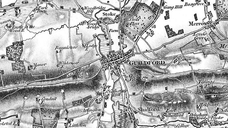
OS maps used for this project were published from 1805 and are now known as the Old Series. They were the first consistent and complete maps of the country, created initially for the southern counties to assist civil defence against the threat of Napoleonic invasion but thereafter expanded into a long-overdue national survey.
The number of sheets was in the hundreds, so manageable. The scale was one inch to the mile (1:63,360), so within touching distance of the present-day metric scale of 1:50,000. The date range was 1805 to 1874 (it was a long project, starting as OS had to from scratch). This last point should have sounded warning bells – but more of that later. The technical challenges were considerable but the task appeared feasible.
The initial job was finding suitable originals. Likely organisations, including the copyright libraries and the Royal Geographical Society, were contacted, as were many cartographic experts. A suitable scanner was obtained. At this point, a problem appeared.
Two centuries of handling and exposure to the air had not improved the originals. Some proved difficult to work with, others impossible. Stains and, to some extent, discolouration could be dealt with: folds, tears and ink spread were more difficult. Where necessary, maps were re-sourced. Some needed to be scanned several times. Eventually a more-or-less suitable asset of originals was digitally created.
The next task was to create a seamless digital layer from which enlarged and re-projected Landranger-matching tiles could be created. First, the sheets had to be joined, which involved cropping the maps to the neat line. At this point, two further obstacles emerged.
First, and perhaps obviously, the maps had never been designed to be joined. Surveying errors and changes in style and head-office instructions combined to create unwanted features ranging from typographical variations to non-abutting roads: all part of the essential nature, even the charm, of the originals but aspects that many present-day eyes might perceive as imperfections.
Lonely Task
In fact, considering the scope of the task, the results were in general stunningly accurate. History provides plenty of examples of measurements that went catastrophically wrong (the SNCF/RFF train fiasco being the most recent) but Ordnance Survey’s 19th-century work is certainly not amongst them. Most mistakes were minor and almost all were probably unnoticed until a map needed to be joined exactly to its neighbour, as Cassini was doing. Some of the faults may have been down to the engravers although the surveyors’ tendency to set up their HQ at the local inn suggests another reason for discrepancies. Often surveyors had no such fireside comforts to distract them, as William Wordsworth poetically recorded after encountering a solitary figure and his “outlandish devices” on the summit of Black Comb in Cumbria in the autumn of 1811.
Chivvied along by indefatigable senior OS officers such as William Mudge, Thomas Colby and Sir Henry James, the army of ‘geographic labourers’ spread across the land, struggling in all weathers and seasons up and down roads and tracks that sometimes proved inadequate for their cumbersome equipment. For obvious reasons they had no reliable maps to guide them. Outright hostility was often encountered from those who suspected the visitors’ motives: on one occasion several surveyors, resplendent in new blue uniforms, which unfortunately made them look like Napoleonic soldiers, were half killed by patriotic Cornish villagers. Against this fraught background the occasional lapse of concentration can be forgiven.
Temptation of Correction
The temptation to digitally correct any errant line-work, howsoever caused, was one Cassini briefly considered and then as quickly rejected. For one thing, this would have altered the originals, always dangerous with historical documents; for another, the task would have been almost never-ending.
More serious was the problem that the original earlier sheets had been constructed using nine separate origins and on three central meridians, the eastern sheets on Greenwich and the western ones on 3°W. This left the central sheets having to fit between these blocks which resulted in their having narrower, trapezial shapes. Although it is unlikely any of these early sheets were constructed on a strict projection, the sheets north of an approximate line between Preston and Hull employed a Cassini Projection with a single origin. (Note that “Cassini” in this connection is a mapping projection and nothing to do with the publishers.)
At this point, something else became clear. Once joined, the variations in the weight of the high-ground hachuring between one original sheet and the next appeared at times almost brutal. Worse, these artistic swirls, which varied from graceful to intrusive, at times obscured more important information such as place names. It’s true that in the 19th century high ground was more of an obstacle than in today’s motorised age but in some areas the landscape appeared Alpine; in others, almost Himalayan. Numerous engravers had left their mark on the work and some had a lighter touch than others. Many of the hachures that needed to be knocked back were darker than the type that needed to be accentuated. To correct this balance and improve the overall legibility, a complex and delicate series of digital-enhancement routines were applied. What worked well for one area did not always do for another without adjustment: so, yet again, automation was impossible.
With later series, printed in colour and with hachures less prominent or non-existent, these challenges were often replaced by others. The Revised New Series sheets, for instance, had background tints which varied from pale yellow to dirty pink, all of which needed to be harmonised as far as possible. Once again, careful compromises had to be made between authenticity and present-day aesthetics.
Character and Challenges
“Every aspect of the work was demanding,” recalls James Anderson, one of Cassini’s founding directors and the person in charge of the map-layer creation. “The Old Series, being the earliest and in mono, was in many ways the hardest, particularly as it was the first one we worked on. But each series had its own character, and so its own challenges that needed to be met.”
Having produced five one-inch series, Cassini then turned its attention to the County Series at 1:10,560 (six inches to the mile) and 1:2,500 as well as other maps at still more detailed scales. Although a good deal of geo-referenced and geo-rectified source mapping was available it was felt this could be upgraded and more mapping was often needed to plug gaps and expand the coverage. As these involved respectively 25 and 125 times more sheets than the one-inch ones, many problems increased proportionately. Furthermore, some editions of the maps only extended to the county line and each county was projected from its own meridian (and sometimes more than one).
“If you imagine a jigsaw puzzle,” Anderson suggests, “with tens of thousands of pieces, some overlapping and others missing or damaged, each group of which needs to be slightly stretched to make it fit together with its neighbours, then you have some idea of the task we faced for each series. Most GIS operations are predicated on consistent original data – this one wasn’t. We also realised that the scans could be enhanced and so wrote the most complex series of routines we’d yet devised to get them to an acceptable standard.”
This took several months for each series. More are constantly being added and all are in a state of constant upgrade. As technology and processing speeds improve so options are available which were wishful thinking even half a decade ago. For instance, larger file sizes are today more acceptable for consumers, many of whom buy the maps as PDFs, so higher-resolution data can now be supplied. Although some perceived imperfections are impossible to correct, considerable and ongoing progress has been spent on enhancing many of the tiles to create cleaner and more balanced results.
From Cassini to Transverse Mercator
Re-projecting the maps from the original Cassini to the present-day Transverse Mercator was the next job and one which, like so many others, would have been a lot simpler were the originals to have been rectangular rather than subtly different trapeziums. The variations in the points of origin and, particularly for the Old Series, occasional surveying errors made it impossible to get an exact fit, no matter how many control points were used. For this reason, the alignment of the map and the National Grid has more potential for error than for the other series OS produced, although for the basic purpose of identifying a location across several different time periods, including the present day, it is more than adequate. Certainly no one else had ever attempted the task. “Looking back on how long it took us,” Anderson states, “I’m not surprised. Indeed, several people told us it couldn’t be done at all.”
This feature was put to the test in the first products derived from these mapping layers, Cassini’s Old Series maps which matched all 123 OS Landrangers of England & Wales with the National Grid as a cyan overlay. Sourcing suitable contemporary images for the covers was another task that took longer than expected but by early 2007 the full series had been published. Attention then switched to the Popular Edition maps from the 1920s, then to the Revised New Series from the turn of the century.
At this stage, Cassini began to get enquiries from a wide range of companies – could the mapping be licensed? The answer, Cassini soon decided, was “yes.” So, if you visit a genealogy website or read a parish magazine, if you buy a gift or respond to a newspaper promotion, if you work in local government or in a school, if you use a hand-held GPS system or an iPhone – if any of these apply and in doing so you encounter one-inch historical OS maps the chances are they’ve been supplied by or licensed from Cassini.
A Steamroller through the Maps
We must now briefly jump back to the early 19th century to when Richard Trevithick was tinkering with his latest invention in Redruth. Trevithick, Stephenson, Brunel and the other steam-power revolutionaries were about to pose Ordnance Survey (and, later, Cassini) a problem.
The railways were built at breakneck speed from the early 1830s, at the same time the surveyors were mapping the central part of the country. All cartographers know that their work will need updating eventually: but it must have been galling for OS to see that, within a few years, a dramatic new feature had been added to the landscape that made their maps as they stood almost useless.
The pragmatic, if inelegant, solution OS adopted was to engrave the railways over the existing plates and re-print. Due to technological constraints this was done without changing other features including – irritatingly for future researchers – the publication date. Many versions of the Old Series maps (mainly in the Midlands) were thus originally from one specified year, yet clearly include a railway that was built, and over-engraved, later. If one sheet had had railways added and its neighbour hadn’t, when joined together the tracks appeared suddenly to stop, as if the navvies had packed up for the weekend and decided not to come back. In the mid-19th century, OS briefly tried to pre-empt this by including projected railways which had received parliamentary approval. This sometimes backfired, for the railway-building boom was ending and many of these routes were never built.
When work on the Old Series started there were no railways: when it finished 70 years later there were over 15,000 miles of them. No combination of original sheets, with or without engraved additions (even assuming ideal ones could be found), could have displayed this transformation with any accuracy. We were left, once again, with either charming imperfections or anachronistic blemishes, depending on your point of view. As with so many of the technical aspects, this problem solved itself with the later series. Here, such features were extant from the outset while revisions and publication were conducted over shorter time spans so minimising the editorial differences between adjoining sheets.
Site Centering
Having created these Landranger-matching maps it soon became clear that there were other ways in which the source cartography could be deployed. Site-centred present-day maps were by now widely available. Having created several series of geo-referenced tiles, Cassini was well-placed to offer historical maps in the same way.
The new challenge was then to create a series of systems which could handle all the aspects of personalised map creation. “There wasn’t then, and isn’t now, one piece of software to do all the necessary tasks,” Cassini’s technical director Philip Johnson explains. Search options such as postcodes and place names required sourcing and editing gazetteers. A system had to be created to crop the maps to pre-defined sizes. It needed to be able to add metadata such as the National Grid and administrative boundaries to the maps and insert personalised inscriptions and dynamic dates beneath them. For scale-variations of the one-inch maps, the data had to be auto-interpolated during the generation of the output files. Everything had to be accessed and viewed in a thumbnail by online customers. Finally, the results needed to be provided through a range of delivery systems supplying specialist fulfillers, the website’s shopping basket and licensee interfaces such as Cassini’s API and Mapmaker-Plus portals. “Moreover,” Johnson concludes, “each stage has to be carefully linked and equally carefully tested whenever we update the software or add new products. And they all have to work together, immediately, 24 hours a day, seven days a week – which they do.”
Indeed, this constant process of re-evaluation and enhancement extends to all aspects of the business. More British series and products are being added and work is already underway on creating similar geo-referenced and geo-rectified tiles of historical maps of western and central Europe. More projects await. James Anderson sums up the journey so far: “We’ve learned many lessons the hard way and have gained more knowledge and expertise than we ever expected. In the process we’ve also created unique datasets, a wide range of products and several bespoke delivery systems. We can now apply all this experience in the marketplace as a leading provider of historical GIS consultancy and geo-temporal data mashups.”
For more information on Cassini’s range of mapping products, datasets and GIS services, please contact enquiries@cassinimaps.com or visit www.cassinimaps.com
This article was published in GIS Professional June 2014

Value staying current with geomatics?
Stay on the map with our expertly curated newsletters.
We provide educational insights, industry updates, and inspiring stories to help you learn, grow, and reach your full potential in your field. Don't miss out - subscribe today and ensure you're always informed, educated, and inspired.
Choose your newsletter(s)