Online Portal with Fast Access to High-quality Water Depth Data
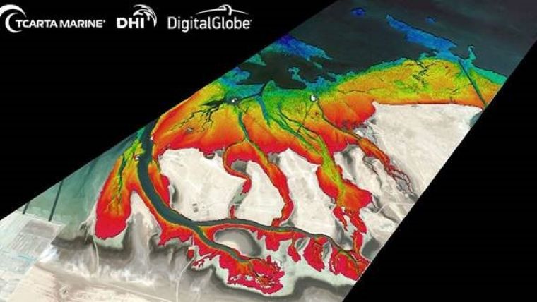
The Bathymetrics Data Portal allows users to search, purchase and automatically download the best available water depth information directly from the online store to their computer. It is a combined offering by DHI, experts in water environments, TCarta, a global provider of marine geospatial products, and DigitalGlobe, a provider of high-resolution satellite imagery.
It is offering continuously expanding 2m bathymetry data in shallow water areas and a global database of interpolated 90m bathymetry. The Bathymetrics Data Portal allows users to search for data in their area of interest and purchase what they need. Data is priced by the square kilometer; the customer pays online with credit card and can download the data shortly after.
Bathymetric products are used extensively by organizations involved in energy infrastructure development, port construction, environmental monitoring, aquaculture planning and hydrodynamic modeling.
The portal is constantly being updated with new and improved data, providing users with the best available bathymetric information around the world.

Value staying current with geomatics?
Stay on the map with our expertly curated newsletters.
We provide educational insights, industry updates, and inspiring stories to help you learn, grow, and reach your full potential in your field. Don't miss out - subscribe today and ensure you're always informed, educated, and inspired.
Choose your newsletter(s)


