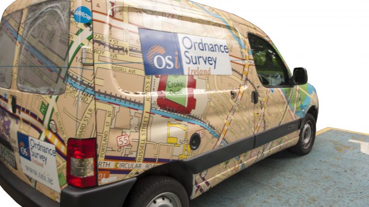
Ordnance Survey Ireland Shows New Perspectives
Part 1: Cartographic Orchestration
The Republic of Ireland is leading the way in national geospatial activities within the international mapping arena. As of this September, Ordnance Survey Ireland (OSi) is the first national mapping agency in the world with the capability to produce 1:1,000,000 cartographic products and services from its 1:1,000 topographic database in a fully automated flowline. OSi has populated a standards-based, object-oriented data model and implemented orchestrated, rule-based production workflows to achieve this result.
This article focuses on OSi’s new rule-based production workflows. A second article will focus on how OSi transforms these new work processes into ‘Mapping as a Service’.
One of the primary roles of a national mapping agency is to provide the authoritative view of the real world through the publication of mapping products and services. In OSi’s case, this means providing products and services at mapping scales ranging from 1:1,000 to 1:1,000,000. Traditionally, OSi’s production methodologies have been geared towards the publication of cartographic products that were aesthetically beautiful. They focused solely on geographic reference (Easting/Northing and Latitude/Longitude) and involved managing a national mapping coverage of over 5,000 individual maps. Today, OSi represents real-world features in a more intelligent way and maintains a single, high-resolution digital landscape model comprised of over 50 million uniquely referenced objects.
Data Integrity
In 2007, as part of OSi’s National Mapping-as-a-Service strategy, OSi decided to create a scale-independent, object-oriented, spatial data storage model called PRIME2. OSi first reviewed advances in the area, both in Europe and further afield. “We identified best in breed and took the opportunity to learn. We also focused on implementing non-proprietary industry standards where appropriate,” says Colin Bray, CEO of OSi. In 2011, OSi began re-engineering its existing data into PRIME2. It transformed its databases into the new data platform, including full rules-based orchestrated maintenance workflows. In 2014, OSi went live with these data-maintenance flowlines. “Maintaining the investment in PRIME2 meant not infecting the new re-engineered data with old work practices,” explains Bray. OSi implemented the orchestrated workflow based on 1Spatial and Oracle technologies. The data collection systems that were introduced ensured that new input from surveyors and other parties was compliant with the PRIME2 data model.
Another part of the project involved documenting OSi’s core operating procedures. This gave OSi the opportunity to reduce the risk associated with any significant loss of corporate intelligence (particularly because of upcoming retirements).
Changes to Data Capture
OSi uses a combination of photogrammetric and field-based data capture methods to maintain its national geospatial platform. “For OSi’s surveyors, the new PRIME2 data model and management systems were a quantum change,” recognises Colin Bray, being a surveyor himself. “When we, as surveyors, looked out of the window, our concept of modelling the world was completely different to what is asked of us today. ‘Geographic location’ used to be everything in our profession. Now we work in a digital society and it’s all about the data. ‘Location’ is now considered an attribute of an object – it enables us to relate the object to the real world.”
The workflow has changed dramatically. Now, when the surveyor is notified about an available job, they must extract multiple objects covering the area of interest and load the extracted job to their tablet. On every interaction a surveyor has with the data, over 200 rules are run simultaneously to ensure that the data captured is compliant with the PRIME2 data model. When uploaded, only those objects that have actually changed will be posted back to the core database. Bray continues: “An additional 400 server-based rules are then run against the newly captured data before they are adopted into the national map. That’s how we look after the investment made in authoritative data – we absolutely have to maintain the integrity of the data.”
Multi-resolution Data Store
The next phase in OSi’s flowline is an automatic update of the model across multiple resolutions. When the photogrammetrist or the field surveyor makes a change to the PRIME2 national map, the change in that object is automatically updated across all the various resolutions of the digital landscape model. Correspondingly, OSi’s digital cartographic models are updated and translated into vector, raster and web services. This automated approach is based on processes and workflows designed and built by OSi cartographers.
This September, OSi has completed a multi-resolution data store (MRDS) project with ESRI, which delivers the capability for OSi to optimise the automated workflows. Bray states: “Our staff have now gained the capability to create automatically generated products using the new process before year end. I am very proud of this, because it means that we are the first mapping agency in the world to generate products from 1:1,000 to 1:1,000,000 in a 100%-automated flowline.” These new workflows provide the capability to create additional resolutions of the core digital landscape model at local, regional and national level. In addition, cartographic models have been created that automate map-making and generalisation regarding topographic consistency, cartographic displacement, geometric simplification, etc. Bray is content: “And with that we have the different products available in raster, vector, web services and the paper products. MRDS is putting us in the position to spin up automated flowlines for any future new product or service.”
Cartographer’s changing role
Cartography remains a crucial requirement to visualise the national map at different resolutions. The role of the OSi cartographer is now very much a systems expert, operating rule-based, orchestrated cartographic production flowlines and systems to create various products and services. The CEO stipulates: “You will struggle to see a difference between a manually produced map with traditional techniques and the one produced from our ESRI-based, automatically generated flowline. But our cartographers do much more than follow rules of traditional cartography. The data changes its look and feel depending on the resolution – there’s no longer just one single view of an object.”
What’s Next for OSi?
“We believe our core data holding is now suitable for use in modern GIS environments and is therefore future-proof based on our current understanding of market requirements,” says Bray. In addition to consulting with the user base, and as part of its data-collection strategy, OSi is now creating semi-automatic production workflows for collecting 3D objects from remote sensing: “OSi has collected in 3D for 25 years with digital photogrammetry, and in 2017 we are developing a new flowline for 3D object maintenance, starting with cities.” OSi also intends to focus on image processing to enable imagery to be stored at pixel level in rows and columns within a database. Bray is convinced: “That is going to be the next generation. We will get the intelligence of our remote sensing data as attribution into the national map."
Colin Bray is chief executive and chief survey officer of OSi. He took up the position of CEO in 2013 after a career as CIO and professional surveyor with OSi since 1998. He is a chartered geomatics surveyor, vice president of the Society of Chartered Surveyors Ireland, and a member of the Public Service Chief Information Officer Council.
Ordnance Survey Ireland is the Republic of Ireland’s national mapping agency. It is a state body and its funding model is made up of commercial revenue (81%) from both the public and private sectors. 19% comes from a Service Level Agreement with the Department of Justice & Equality for national interest mapping. In total, 60% of its commercial income comes from the public sector. In addition to the head office based in Dublin, OSi has six regional offices and a total staff of 223.

Value staying current with geomatics?
Stay on the map with our expertly curated newsletters.
We provide educational insights, industry updates, and inspiring stories to help you learn, grow, and reach your full potential in your field. Don't miss out - subscribe today and ensure you're always informed, educated, and inspired.
Choose your newsletter(s)


