Satellite Images of Greece Flood Help Government Response
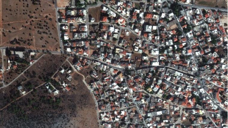
A flood west of Athens, Greece, was caused by heavy rain on 15 and 16 November 2017 and caused the death of 22 people. European Space Imaging captured 30cm resolution images of the area using the WorldView-4 satellite on 21 November 2017. The images clearly show the damage wrought by the torrents of water and mud, and the path the water took as it flowed down the sides of the mountains and into gullies.
The cities of Mandra, Elefsina, and Nea Peramos were most affected with 1,184 buildings suffering damage requiring significant government compensation. It has been reported that inappropriate urban development may have been a major contributing factor to the event's severity, as natural floodways have been blocked by unlicensed construction.
The satellite images were made immediately available to the Space Applications and Remote Sensing Institute of National Observatory of Athens for the purpose of planning and maintaining situational awareness of the event in collaboration with first responders and government agencies," according to Vana Giavi, managing director of TotalView, European Space Imaging's partner in Greece.
"The very high resolution satellite imagery will be an invaluable tool for the Greek government to detect the presence of illegal buildings, and to plan future flood-prevention infrastructure," said Adrian Zevenbergen, managing director of European Space Imaging.

Value staying current with geomatics?
Stay on the map with our expertly curated newsletters.
We provide educational insights, industry updates, and inspiring stories to help you learn, grow, and reach your full potential in your field. Don't miss out - subscribe today and ensure you're always informed, educated, and inspired.
Choose your newsletter(s)


