Taking Tools to People for Offline Mapping
Accurate maps play a critical role in understanding communities, particularly for populations at risk of natural disasters and health emergencies. Dan Joseph and colleagues explain how the American Red Cross has mobilised thousands of volunteers to help map vulnerable communities around the world.
Much of the Global North has been mapped with incredible detail and is accessible through the smartphones in our pockets. This is not the reality for billions of people around the globe, however. Families and individuals often do not exist to decisionmakers because their communities do not exist on maps. Without maps, disaster responders often cannot access neighbourhoods or assess community scale, proximity, infrastructure, demographics, or hazards – preventing lifesaving resources from finding those most in need.
Recognising this need, the American Red Cross, in partnership with the Humanitarian OpenStreetMap Team (HOT), the British Red Cross, and Médecins Sans Frontières UK, launched an innovative project called Missing Maps, which aims to put 200 million vulnerable people on the map by 2021. This involves adding the communities where people live to OpenStreetMap (OSM), where the data is openly available for use and revision.
Missing Maps has engaged more than 12,500 digital volunteers in this humanitarian effort. In the 20 months since its launch in November 2014, the project has mapped communities of an estimated 20 million people. The majority of this progress was made possible through remote mapping efforts where the Red Cross and its partners host mapping parties (“mapathons”) in cities around the world. We often work with university groups or even private corporations who are interested in bringing people together to trace buildings and roads from satellite imagery in order to map a vulnerable area.
Basemaps in Days
Outside of mapping parties, volunteers also remotely contribute to mapping tasks. These efforts very quickly result in basemap data for the area of interest. Over a matter of days, a community can go from a blank spot on the map to a detailed collection of buildings and roads. This gives humanitarian agencies the necessary data to plan and organise their community development and disaster preparedness/response activities.
Remote mapping rapidly produces data but faces certain limits. Building and road outlines provide a baseline of essential information for humanitarians, but additional information is necessary to make the map more complete and useful. It is impossible to tell from satellite imagery where hospitals, schools, water and sanitation facilities, community landmarks, and physical hazards are located. Moreover, local community engagement is important in order to promote sustainability and a sense of ownership over the map data. Therefore, the American Red Cross has put increasing focus on field mapping efforts.
Mapping 6000+ Villages in West Africa
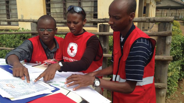
This past year, the American Red Cross undertook its biggest field effort to date: launching a mapping hub in West Africa and training local volunteers to field map more than 6,000 villages in the border regions of Liberia, Guinea, and Sierra Leone. Covering an area nearly as large as Switzerland, this project was a massive effort to scale up our Missing Maps field efforts in a rural region full of technical challenges: no internet connectivity, extremely poor roads, lack of electricity, dispersed volunteers, etc. This project required us to take a serious look at what was needed to take existing mapping tools and make them usable at scale in such a remote area.
Preferred Tool
A combination of high- and low-tech tools facilitate field mapping. Our preferred tool is OpenMapKit, an Android app developed by the American Red Cross that enables a user to pre-download the OSM map of an area, shows the user’s GPS location, and with a simple tap on a building or road in order to add information about the location. When a feature is tapped, a brief set of questions will appear, asking the user to identify the feature (e.g. school, residential building, health facility) and for any other relevant information. When the use of mobile phones presents security concerns, or other factors necessitate an alternative method, the American Red Cross uses paper-based mapping tools (such as FieldPapers, a tool which enables users to print map pages for an area, annotate the pages by hand, and then scan/edit/upload the annotated information to OpenStreetMap).
Humanitarians, in general, have become increasingly reliant on cloud-based tools for use in remote areas. For mapping projects specifically, users previously needed an internet connection in order to download map areas at the beginning of a project, and then to upload data into OSM at the end of each day. FieldPapers also requires an internet connection to prepare map atlases. Reliable internet access on a daily basis is not realistic for many areas in which the Red Cross works.
We needed to be able to map and use our tools without internet connectivity. Portable OSM (POSM) was our solution. It brings together a suite of tools that unite field data collection with editing OpenStreetMap in a disconnected, offline environment. We have built POSM to run on a cheap, low-powered computer called the Intel NUC. Running Ubuntu Linux, the Intel NUC broadcasts a Wi-Fi hotspot from which we have integrated a local instance of OpenStreetMap along with OpenMapKit and Field Papers. Users are able to download an area of interest, easily configure the portable server, work offline in the field, and then return to a connected environment and sync all changes back to OpenStreetMap.
Aerial Imagery
Satellite or aerial imagery can be an important component in a mapping workflow, as it provides raw material for tracing features and focusing field enumeration activities. Converting acquired imagery to an online Tiled Map Service (TMS) which can be used with existing web tools requires a number of steps and a high bandwidth internet connection.
As an augmentation to satellite and other aerial imagery, the detailed, cloud-free view that small unmanned aerial systems (sUASs) provide is useful for disaster preparedness, has great potential for field tactics, is helpful for allocation of resources during relief coordination and is an excellent input to OSM mapping workflows. Currently, there is no open source workflow that allows American Red Cross to deploy to the field fully offline, fly a sUAS to collect aerial imagery, process the imagery and allow for editing of OSM data over the processed orthorectified aerial imagery.
American Red Cross has partnered with the Cleveland Metroparks and Stamen to implement OpenDroneMap (ODM) as a field-deployable module for use on POSM devices. This development will bring an open source sUAS imagery processing toolchain to the other mapping tools that have already been incorporated into POSM.
The American Red Cross – together with its partner organisations and Red Cross societies in other countries – has been working to map disaster-prone communities around the world. By supporting mapping in vulnerable communities, humanitarians are able to share better analysis of hazards, mitigations, and response capacity in communities, enabling stronger disaster response efforts and programme planning in the future.
We focus on open data, open source tools, and community engagement, evolving new methods and tools to meet challenges experienced along the way. These same goals and experiences are evident in the volunteer and open source communities we enjoy being part of. Beyond being consumers of OSM data and FOSS4G software, we strive to contribute back. This project is being developed in the open on GitHub and we welcome feedback and help. https://github.com/AmericanRedCross/posm
This article was published in GIS Professional October 2016

Value staying current with geomatics?
Stay on the map with our expertly curated newsletters.
We provide educational insights, industry updates, and inspiring stories to help you learn, grow, and reach your full potential in your field. Don't miss out - subscribe today and ensure you're always informed, educated, and inspired.
Choose your newsletter(s)


