The Fourth SuperGIS Cup Draws to a Close
The SuperGIS Cup is considered the highest level of competition for GIS in Taiwan, and the 4th SuperGIS Cup has come to an end. This annual event aims to promote spatial technology and its applications with students involved getting more acquainted with the operation GIS software.
The idea is that students will then be able to link their knowledge to their daily lives and widen their horizons, be more concerned about environmental issues and sustainable development, and become capable of developing a solution for complex problems to better the society. The ultimate vision of SupergGIS Cup is seeking distinguished future stars from the participants to develop more advanced GIS products and make them more popular. Yu-Tang Lin and Cheng-Zhe Lee (both having graduated from the University of Taipei with Mayor’s Award in June of 2018, and members of last year’s champion), both unveiled the competition.
After a strict evaluation process, several GIS projects were selected for the second stage. Participants were then tested on their GIS operation skills, with time constraints in the morning. Then, in the afternoon, each team had to present their creative GIS solutions in 15 minutes and the jury panel were allowed to spark off intense debates about their proposal. The competition judges were Prof. Shen-Lung Kao from National Taiwan Ocean University, Prof. Ji-Wen Li from Chien Hsin University of Science and Technology, Prof. Yi-Chung Chen from Yunlin University of Science and Technology, and product team specialists from Supergeo.
In the final stage of the competition, the audience offstage could all see participants’ great passion from their vivid expression and firm attitudes towards their topics. The jury panel were also very impressed by the extraordinary performance of all competing teams because their topics had wide coverage of GIS application fields such as 3D building model, UAV, digital archiving of literature and cultural history, community infrastructure establishment, and tourism and recreation planning. One team even made good use of open data from the government and applied the neural network to improve the mass transportation system. All of these had showcased the great creativity and potential of the participants.
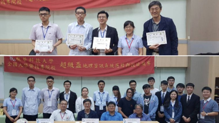
In the end, the top 3 went to the teams from Prof. Sheng-Lin Chang, Prof. Ji-Wen Li, and Ming-Chih Wang, respectively. The jury appreciated the efforts made by all competing teams as they dealt with problems comprehensively, combined the theory and practice in creative ways, and demonstrated a high level of feasibility as well. For students involved, they said they’ve earned precious practical experience and it has opened the door to the real world. They have learned how to explore the world outside their school and always be enthusiastic about solving the complicated issues in the society. During this process, they will also be able to find their personal values and the meaning of lives.
Follow the latest news of the next event at http://tw.supergeotek.com/index.php/supergis_contest/

Value staying current with geomatics?
Stay on the map with our expertly curated newsletters.
We provide educational insights, industry updates, and inspiring stories to help you learn, grow, and reach your full potential in your field. Don't miss out - subscribe today and ensure you're always informed, educated, and inspired.
Choose your newsletter(s)


