The Future of Geospatial Education
GIS Professionals need to diversify their skills and quickly learn emerging technologies, argues Patrick Rickles.
The use and understanding of GIS was historically limited to specialists. Today, GIS is commonplace, as spatially-enabled apps become standard on smartphones. With over a third of the world’s total population – an estimated 2.6 billion people - owning smartphones, and a reported 5 billion requests per week to Apple Maps alone, there are a large number of non-expert users of GIS, which is only sure to grow. GIS professionals need to diversify their skillsets and quickly learn emerging technologies in order to support these new users, many of whom are coming from a variety of backgrounds, in achieving what they want with GIS.
This poses a challenge to GIS educators in preparing for an unknown yet exciting future with geospatial tools. For these educators, evolving frameworks exist in formal education, such as the Geographic Information Science and Technology Body of Knowledge, which may provide them with guidance on GIS concepts that students should learn; and what about those wanting to use GIS who are not pursuing formal education? What resources and learning approaches are they using?
Variety of GIS Learners
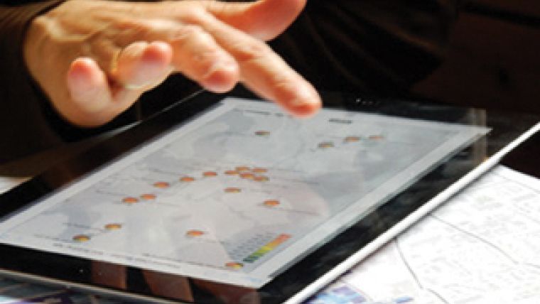
As a GIS educational specialist, I teach and work with a variety of GIS learners, from students on formal education programmes hoping to become industry professionals, to members of the public taking part in science projects (Citizen Scientists), such as those shown in Figure 1. These non-GIS professionals increasingly need to make accurate, visually appealing maps. However, they are less likely to require a thorough understanding of all traditional GIS concepts and skillsets.
To better understand the informal learning approaches used, I conducted a survey of researchers from a variety of disciplines who needed to use GIS for work but did not learn GIS through formal education. When asked about methods used to learn GIS, as well as the perceived effectiveness of the learning method, the results, shown in Figure 2, suggest that searching the internet, watching a video, following a tutorial or asking a more experienced person for help were the methods utilised and considered effective.
Simple and Self Explanatory
When working with Citizen Scientists, I find that they employ similar informal learning efforts when learning GIS, so I tailor tutorials and educational materials accordingly. An example, which I recently coauthored, utilises Survey123, Esri’s mobile data collection platform, to create emergency preparedness lists, based on the Challenging RISK Citizen Science project. Teaching and applying these tools in a non-academic or multidisciplinary setting necessitated that educational materials were both simple and self-explanatory, and that the teaching support provided was delivered with patience and sensitivity to individual learning processes, cultural differences and digital proficiency. Therefore, on top of technical skills, I believe it is also necessary for GIS professionals to acquire a wider skillset – particularly the ability to communicate complex information in an understandable and inclusive way. Educators may have difficulties translating these skills and incorporating them into formal or informal learning structures, but innovative educational practices may make this possible (e.g. real-world case studies, service-learning, etc.) and would benefit GIS learners.
The future of GIS education should provide a flexible structure to teach the increasing number of learners who are new to the important concepts of GIS, yet allow them to challenge convention and innovate. GIS educators and learners will both need to expand their understanding of approaches to learning and make use of a variety of resources that may be available to them. The combination of technical and non-technical skills can be powerful in driving forward initiatives with GIS, so incorporating them in to educational resources, if possible, would be beneficial to learners. Overall, I believe GIS educators are rising to the challenge and that there is a bright future for GIS and GIS education.
---------------------
References
- i http://www.ucl.ac.uk/challenging-risk (last accessed 08 March 2017)
- ii https://www.statista.com/topics/840/smartphones/ (last accessed 08 March 2017)
- iii http://fortune.com/2015/06/16/apple-google-maps-ios/ (last accessed 08 March 2017)
- iv http://gistbok.ucgis.org/ (last accessed 08 March 2017)
- v 45 academics (various universities) from 17 uniquely identifi ed disciplines that included
GIScience [6], geography (physical and human) [4], remote sensing [3], computer
science and software engineering [2], forestry [2], cartography [1], ecology [1], education
[1], general humanities [1], history [1], librarianship [1], marine biology [1], music [1],
oceanography [1], petroleum engineering [1], psychology [1], and urban and rural planning
[1] (16 respondents did not identify their discipline) - vi http://learn.arcgis.com/en/projects/get-started-with-survey123/ (last accessed 08 March
2017)
This article was published in GIS Professional April 2017

Value staying current with geomatics?
Stay on the map with our expertly curated newsletters.
We provide educational insights, industry updates, and inspiring stories to help you learn, grow, and reach your full potential in your field. Don't miss out - subscribe today and ensure you're always informed, educated, and inspired.
Choose your newsletter(s)


