UK Land Cover Change and CORINE
Keeping track of land cover change is essential for governments and planners in the EU. For the UK this can only be done through Earth Observation techniques. Dr Geoff Smith explains how a land cover map has been continually updated for more than three decades.
Over the last 30 years, the CORINE Land Cover (CLC) map has become the de facto standard for land monitoring across Europe. CLC was born out of the Coordination of Information on the Environment (CORINE) Programme proposed by the European Commission (EC) in the mid-1980s. CORINE overall aimed at gathering information relating to key environmental issues and thus supporting priority topics for the European Union (EU), such as land take, coastal erosion, biotope definitions, etc.
The land cover component of CORINE was designed to provide consistent localized geospatial information on the land cover and land use of the Member States (MS) of the EU based on Earth Observation (EO) data. The CLC map specification has remained relatively fixed since its establishment and provides a pan-European inventory of land cover and land use, using a hierarchical nomenclature with 44 classes at its third level.
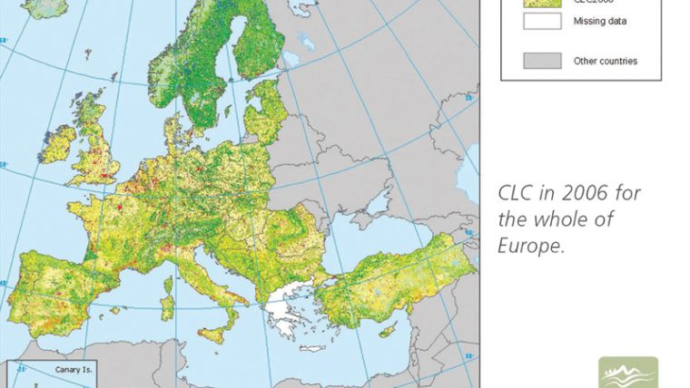
The map product is made up of vector polygon features with a minimum mapping unit of 25ha and minimum feature width of 100m which roughly equates to 1:100 000 scale. Over the last three decades, there have been four CLC maps representing the status of the European landscape in 1990, 2000, 2006 and most recently 2012. To improve the estimation of change the CLC maps have been accompanied by a CLC-Change product since 2000, which uses the same nomenclature, but records features as small as 5ha. The CLC is produced by each MS, the project is overseen by the European Environment Agency (EEA) and technical support was provided by the European Topic Centre on Urban, Land and Soil systems (ETC-ULS).
Adapting to Change
Over such a time period the CLC has adapted to both developing technology and changing organisational structures. In 1990 CLC was produced by a hand-drawn interpretation of printed Landsat 5 ~ 30m spatial resolution multi-spectral images onto large acetate sheets, which were later digitised into a GIS system. By 2000 this approach had been superseded by computer-aided on screen interpretation, which was developed further until in 2012 when a dedicated software system became available including links to GoogleEarth and the use of multiple layers of satellite imagery and ancillary data to support the interpreters.
Once the initial products (e.g. 1990 status) had been prepared in a conventional mapping sense, change-only updates were the main approaches to revision. In this way, the updated product was generated by combining the previous map and the changes. Alongside this change-only update, some MS also developed bottom-up generalisation approaches where more spatially and thematically detailed national land cover / land use datasets were transformed into the CLC specification. In this way, a large pool of experience and best practice has been compiled to support the development of future European land monitoring concepts.
More Countries
As well as technological developments, CLC has undergone a number of organisational changes. Primary amongst these has been the increase in the coverage of the product as more countries joined the EEA, which now has 33 member countries and six cooperating countries. This has required the development of sophisticated documentation and guidelines and the establishment of a dedicated support team for the large number of production teams and operators involved in the process.
The CLC production has also developed and adopted a number of centralised activities such as the provision of satellite imagery for all MS and the pan-European aggregation and validation of products into a seamless end result. In 2012, CLC was taken under the wing of the Copernicus Land Services. The Copernicus programme is the European EO programme involving both the provision of satellite images, through the Sentinel constellation, and information products, through a series of services. CLC is now part of the continental land services along with a set of other complementary land surface products. CLC, therefore, continues to be a key database for integrated environmental assessment and support for EC policy and is likely to remain so in some form for the short to mid-term.
A team at the University of Leicester, supported by Specto Natura Ltd, have recently completed the most recent update of CLC of 2012 for the UK. The interpretation of satellite images took two years and was carried out by a small team led by Prof. Heiko Balzter with funding from the European Union and the UK Department of Environment, Food and Rural Affairs (Defra). For the reference year 2012 the CLC status layer represents the only land cover information available for the UK and at the scale of 5ha the CLC Changes map provides an important source of land cover and land use change information between 2006 and 2012.
Habitat loss highlighted in UK The most dominant land cover type in the UK in 2012 remained agricultural land, followed by forest and semi-natural vegetation. Artificial surfaces represent only 8% of the country with the majority being urban settlements. The results from the CLC-Changes showed an area of 225,200ha (or 1% of the total area of the UK) had experienced a change in land cover or land use from 2006 to 2012. Although a total of 167 different types of change were seen from the satellite images, the UK changes are dominated by forest management, therefore their concentration is higher in Scotland and Wales, following the general distribution of managed forest. On a much smaller scale than the forest changes, the key finding of the update was an apparent loss of semi-natural habitats, agricultural land and wetlands nationally, much of which is being converted to urban development. An interesting change was a significant amount of conversion of upland coniferous forest to industrial areas mainly in Scotland related to the development of windfarms. Also, over the whole CLC time series it appears the rate of conversion of land to sport and leisure facilities – mainly golf courses at this scale – continues to decline.
Although not always considered a first choice resource at the UK level with other competing products, the CLC time series of status and change information is now becoming a powerful record to support environmental assessment and policy development within a European context. The adoption of CLC within the Copernicus Land Services will open many more opportunities for the development of applications based on European products with relevance at the UK level and below. The Copernicus Land Services will be officially launched at the ‘New horizons for European and Global land monitoring’ event in Copenhagen in October demonstrating the long term commitment to the CLC and Copernicus Land Services in general. More at http://land.copernicus.eu/event.
This article was published in GIS Professional October 2015

Value staying current with geomatics?
Stay on the map with our expertly curated newsletters.
We provide educational insights, industry updates, and inspiring stories to help you learn, grow, and reach your full potential in your field. Don't miss out - subscribe today and ensure you're always informed, educated, and inspired.
Choose your newsletter(s)


