Spottitt Launches Cloud-based Geospatial Data Analysis Platform
Spottitt Ltd. has launched a cloud-based workspace that puts massive satellite imagery sources and advanced analysis capabilities at the fingertips of energy, environment, and infrastructure professionals. The Spottitt service is available through Veracity - DNV GL’s (a global quality assurance and risk management company) industry data platform and online marketplace.
“Spottitt provides users with everything they need to extract valuable information from satellite imagery and related data sets in a secure, self-service cloud workspace,” said Spottitt CEO Lucy Kennedy. “Clients do not need powerful computers, image processing software or formal GIS training to leverage the value of geospatial data.”
Users can set up a Spottitt account through the Veracity digital marketplace. DNV GL established the Veracity ecosystem to provide easy access to databases, analytics, and applications for its worldwide customer base in energy, maritime and other industries.
The Spottitt online portal gives users instant access to multiple satellite image sources, including open source data from the U.S. Landsat and European Sentinel-2 satellites and sub-metre commercial image products from Airbus Defence & Space and DigitalGlobe. Other geospatial products include Digital Elevation Models (DEMs) and infrastructure feature layers.
“A user simply defines their geographic area of interest, and the system provides thumbnail images of available data sets for purchase,” said Kennedy. “The experience is fast, simple and efficient thanks to cloud-based processing and storage.”
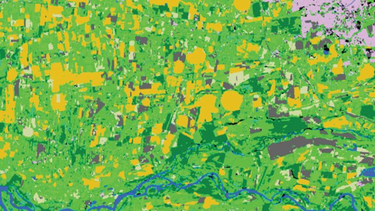
The major differentiator of Spottitt is the powerful data analytics it offers in the cloud. The user selects from a variety of enhancement and information extraction algorithms that can be applied to their chosen data set.
“Analytics results are delivered to the client workspace for viewing, editing, and further manipulation within Spottitt,” added Kennedy. “They can be shared with other users or downloaded in GIS-ready formats into other mapping software environments.”
The Spottitt solution has already been used extensively in the renewable energy and infrastructure management fields. Energy firms have used it to select the optimal locations for wind turbines by mapping land cover and terrain characteristics in areas of interest. The building recognition and change detection analytics are ideal for energy utilities to monitor changes and risks in infrastructure assets over time.
Spottitt workspaces are securely hosted in the Microsoft Azure cloud, giving clients access from any browser-equipped device at any time. Clients are offered the option of paying for imagery and processing as they go or under subscription arrangements.
To learn more, request a free demonstration, and receive an exclusive discount, visit https://go.veracity.com/SpottittEnergy

Value staying current with geomatics?
Stay on the map with our expertly curated newsletters.
We provide educational insights, industry updates, and inspiring stories to help you learn, grow, and reach your full potential in your field. Don't miss out - subscribe today and ensure you're always informed, educated, and inspired.
Choose your newsletter(s)


