Working with the GIS Industry - Benefits of Research and Education
A key component of many MSc degrees offered in Universities in the UK – particularly those that fall under the heading of ‘vocational’ programmes – is the importance of external links – to what some of us might call the ‘real-world’.
The reasons behind establishing these links are many, but include: to (a) bring outside expertise into the classroom through the provision of guest lectures; (b) provide a way to help students engage with practitioners in the discipline or profession; (c) broaden student horizons; (d) help students begin to network with professionals and practitioners; (e) provide opportunities for students to undertake projects of interest and of use to industry; and (f) provide a pathway to a future career.
Whilst the word ‘industry’ could just be used to mean the commercial world here, in this article the use of the word is broadened to include consultancies, government agencies, and even academia, all of whom can provide valuable input to the student experience for many MSc degree programmes.
Theory and Practice
With an increasing demand for MSc degree programmes that lead to a job being one of the drivers for many students returning to University – either immediately after their first qualification – or later in life – perhaps as a way to change direction or to seek employment – most MSc GIS degree programmes generally seek to combine an element of theory and practice within the modules offered to students.
Theory is clearly very important to GIS education – after all, it is an inherently practical subject – providing valuable insight into the philosophy of GIS and essential background to gain an understanding about geospatial analysis. However, being able to ‘practice what you preach’ is crucial to applying GIS in the workplace. Prospective employers typically look for graduates with both a good background knowledge and understanding of the breadth of the subject matter, but also seek individuals with good practical skills and an ability to communicate with a wider audience. In addition, the individual with a positive, outgoing, and team-spirited personality can be a great help in securing a position at interview. Whilst academic programmes clearly strive to assist in developing these personal attributes, employers often perceive there still to be a gap between academic education and the needs of employers as far as providing the right combination of transferable skills to allow a successful transition from the educational environment to employment.
To this end, exploring different ways to engage with potential employers is vital in order to help academic programmes prepare students seeking employment for the demands and rigours of the outside world, whilst at the same time providing potential employers with the means to access academia and to provide a direct line and platform to be able to offer their advice and to determine how they can best play a role in developing the links necessary to bridge the perceived gaps.
Links with Industry
At Aberdeen, the MSc in GIS programme has sought to try to address the perceived gaps in a number of different ways. These include:
Guest Lectures: Inviting guest lecturers from ‘industry’ to: (a) add value to the coverage in modules; (b) expose students to aspects of GIS that are best delivered by a professional/practitioner; (c) convey examples of current ‘real world’ GIS applications to students; and (d) help students to interact and network with researchers and practitioners; in some cases leading on to the provision of external dissertation projects, work placement, and supervision.
Dissertation Projects and Supervision: In addition, external organisations are frequently sought to provide dissertation placements, internships, and supervisory roles in association with the University. This may take the form of a project with supervision, a summer internship, and in some cases a longer-term job opportunity both leading up to and after the student graduates.
Making the Most of Masters (MMM) Programme: For a number of years the MSc in GIS degree programme has also been involved with the Making the Most of Masters (MMM) project that seeks to place students with external organisations who put forward a dissertation project for completion.
External Industrial Advisory Board (EIAB): Another successful approach has the establishment of an External Industrial Advisory Board (EIAB) for the MSc in GIS degree programme comprising representatives from different types of external bodies, organisations, commerce, and government who can bring different knowledge, expertise and backgrounds to the programme. They also provide feedback on the programme modules and content, and advise on specific areas of common interest. The EIAB usually meets once a year to discuss the degree programme and its content, as well as to provide input to the programme in different ways ranging from the provision of guest lectures, site visits, projects, and supervision.
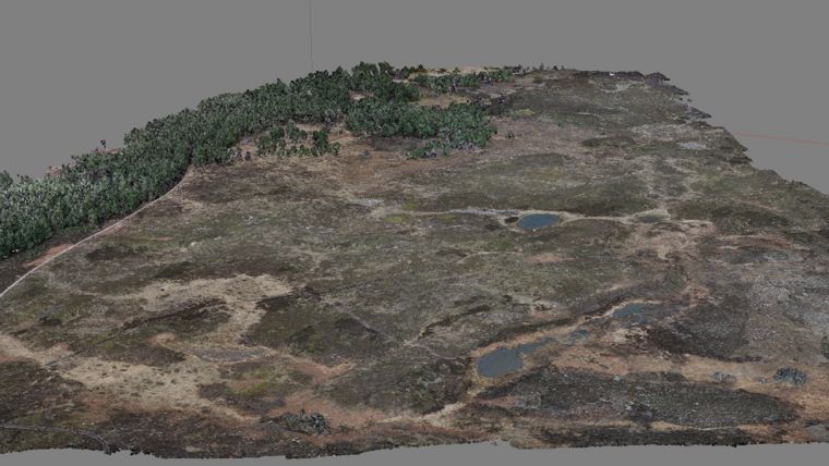
Linking Research to Learning and Education: As a way to bring various elements of academic research to the students in the MSc in GIS degree programme, developing links to research projects is also important. Within the University there are two research centres that currently offer opportunities for student projects: AICSM (Aberdeen Institute for Coastal Science and Management) and UCEMM (UAV Centre for Environmental Monitoring and Mapping). The latter, in particular, has seen a number of successful commercial links developed to explore the environmental applications of UAVs or drones for remote sensing, monitoring, mapping and modelling. Examples have included both MSc and PhD projects on: vineyard monitoring and mapping; stream channel modelling; coastal monitoring; river habitat studies; saltmarsh, bogs, and wetland monitoring and mapping glacial geomorphology (Figure 1); farm mapping, and the remote sensing of cliffs for Search and Rescue (SAR).
External Collaboration: Collaborative work with both non-commercial organisations and commercial companies offers many benefits for the student experience, including access to hardware and software, expertise, project supervision, guest lectures, site visits, training, and contact and networking opportunities with, in some cases, a summer internship that can later evolve into longer-term graduate employment. In recent years our students have been able to work with Aberdeen City Council (ACC), Scottish Natural Heritage (SNH), the Moray Firth Trout Initiative, Knock Farm Ltd., the Esk Rivers and Fisheries Trust, the NHS, Chevron, Fugro, Shell, Positioning Resources Limited and Andrews Survey, as well as GPS and UAV/drone suppliers and operators including Positioning Resources Limited, Borich Aircams Limited, Buzzflyer Limited, EagleiSystems Limited, GeoDrones Ltd. and Bristow Aerial Solutions Limited (UAS Operations) (Figure 2).
Workshops: The final stage of the MSc in GIS degree programme involves students presenting their dissertation research work to a wider audience. Although they complete a written document from their project research, they are also expected to present their work - in the form of scientific poster and presentation - as part of an open invitation workshop. This provides a valuable opportunity – just prior to graduation - for external bodies to see first-hand the work of the students they have been involved with, and an informal way for them to meet with and assess students (Figure 3).
Conferences: The ESRI UK Scottish Conference held annually in Perth, Scotland is also an excellent opportunity for students to find out about some of the current GIS applications, to meet with GIS practitioners, to start to network, and to meet with some of the ESRI UK staff, as well as to be able to hear about some of the upcoming and future developments in ESRI products.
Student Profiles: The MSc in GIS Degree programme also maintains up-to-date student profiles including career paths. These are particularly useful for vocational degree programmes and provide valuable indicators for future prospective students to consider their possible career paths and job opportunities when graduating with an MSc in Geographical Information Systems (GIS) (Boxes 1 and 2).
Future
Future plans to extend the current links to the outside world will include workshop sessions for mock job interviews, and open-day meetings with potential employers to provide students with insights into realistic approaches to assessment and to meet with representatives of industry who actively use geospatial technologies in their work, and to consider the range of job opportunities on offer.
To date, our experience with the ‘real world’ has all been very positive and an aspect of the MSc in GIS Degree Programme that students thoroughly enjoy and benefit from in both the short- and long–term, with many ending up in long-term employment in their chosen field when they graduate.
The obvious benefits for the employer, besides being able to find good candidates for jobs, is to be able to liaise directly with the academic world to see what we do, how we do it, and for us to benefit from their expertise, in-kind contributions, and to see how we can better meet their educational, research, and training requirements.
This article was published in GIS Professional December 2017

Value staying current with geomatics?
Stay on the map with our expertly curated newsletters.
We provide educational insights, industry updates, and inspiring stories to help you learn, grow, and reach your full potential in your field. Don't miss out - subscribe today and ensure you're always informed, educated, and inspired.
Choose your newsletter(s)


