AiC Launch New Version of n4ce
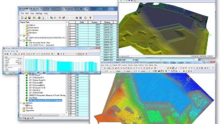
Applications in CADD (AiC) Ltd has launched its biggest revision to its n4ce mapping and modelling software, with fully integrated Point Cloud processing. This means you can mix your traditional survey features and terrain surfaces with the cloud data, thereby interacting with all the available information and introducing true design in 3D. With its multi-screen interface digitising coded features in the 3D view, it quickly produces deliverables in the survey model, as if surveyed via more traditional means.
Specialist cloud editing tools are available for taking sections through the cloud and identifying features from the intensity of points in the cloud.
AiC has also introduced new licensing for n4ce, that allows users to select perpetual or renewable licences based on software keys. This makes it much easier for AiC to provide 30-day trials, and to supply or upgrade users across the internet with new licences. USB Dongles will be retained, on request, for perpetual licences.
In addition, AutoCAD DWG/DXF import & export support has been updated to 2018 specifications. For further details go to www.appsincadd.co.uk

Value staying current with geomatics?
Stay on the map with our expertly curated newsletters.
We provide educational insights, industry updates, and inspiring stories to help you learn, grow, and reach your full potential in your field. Don't miss out - subscribe today and ensure you're always informed, educated, and inspired.
Choose your newsletter(s)


