Airware and senseFly Sign Global Partnership Agreement
Airware, which provides end-to-end solutions that turn aerial data into actionable business intelligence for enterprises, has signed a global distribution agreement with senseFly, the world’s leading producer of fixed-wing mapping drones, to bring the survey-grade eBee Plus to its enterprise customers.
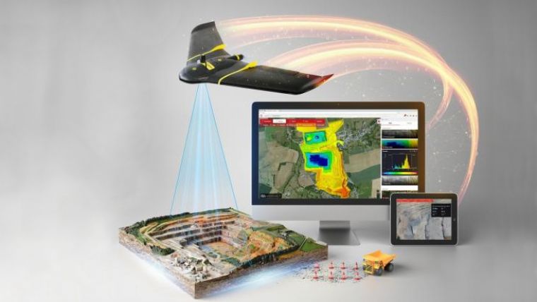
Airware’s end-to-end solutions for mining, quarrying, and construction sites harness drone technology to capture aerial data and translate it into measurable business impact for Fortune 500 companies around the world. As a result of this commercial partnership, the most globally utilized, commercial-grade, large-area mapping drone is now offered as part of Airware’s enterprise offering, which includes cloud-based data processing, analytics, and reporting, as well as the training, support, and professional services enterprises need to deploy drones at scale.
“By combining senseFly’s globally-proven, large-coverage eBee Plus platform with Airware’s unique cloud-based business intelligence, we are creating a truly enterprise-ready solution; a solution that enables customers to safely collect, and act upon, the geospatial data they need, for example when planning operations, calculating extraction volumes, and monitoring a site’s evolution over time,” said Jean-Christophe Zufferey, senseFly’s CEO.
senseFly’s lightweight and durable eBee Plus mapping drone features built-in RTK/PPK functionality, for survey-grade precision, and can document 220 ha (540 ac) in a single 59-minute flight (122 m / 400 ft AGL).
“To take full advantage of aerial data, surveyors demand that their tools provide survey-grade accuracy, efficiency, and flexibility. The eBee Plus more than meets these requirements,” said Jonathan Downey, the founder and CEO of Airware. “Pairing the eBee Plus’ aerial efficiency and photogrammetric accuracy with our powerful enterprise-grade workflow enables companies to ensure compliance, enhance worker safety, and capture more accurate, repeatable data to improve decision-making.”
Airware will distribute senseFly’s eBee Plus across the globe as part of their enterprise solution offering. This solution is available within the global Cat dealers network as elements of the Cat Connect offering, which focuses on improving site and operation efficiency through a suite of industry specific products and services.
As a result, Cat dealers will be able to offer their customers enterprise drone solutions that combine senseFly’s automated data collection with Airware’s enterprise-focused workflow, professional services, training, and cloud-based analytics that turn aerial data into business intelligence.

Value staying current with geomatics?
Stay on the map with our expertly curated newsletters.
We provide educational insights, industry updates, and inspiring stories to help you learn, grow, and reach your full potential in your field. Don't miss out - subscribe today and ensure you're always informed, educated, and inspired.
Choose your newsletter(s)


