DigitalGlobe Releases Satellite Imagery of California Wildfires
DigitalGlobe has released satellite imagery and data of the wildfires in California through their Open Data Program.
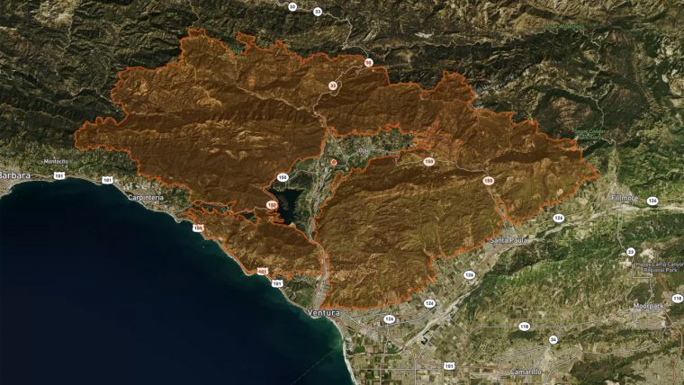
The publically released imagery is for Ventura, California, and the surrounding communities and will expand coverage based on the fire’s activity. DigitalGlobe partnered with Mapbox to update their fire tracking map with the latest imagery. This map allows users to search addresses and zoom in on specific areas in or near the fire zones, and it includes the latest fire perimeters provided by first responders on the ground. View the map here: www.mapbox.com/labs/norcal-fire-2017/
Also available for publication are several JPEGs taken by DigitalGlobe’s WorldView-3 satellite, which has a Shortwave Infrared (SWIR) sensor that can pierce through the smoke and show where the fires are burning on the ground. The 6 December images show fires burning in the mountains east of San Fernando, both in natural colour, with smoke visible, and SWIR, which is smoke-free. The 7 December images show Mira Monte, Oak View, and Casitas Springs using the SWIR bands.

Value staying current with geomatics?
Stay on the map with our expertly curated newsletters.
We provide educational insights, industry updates, and inspiring stories to help you learn, grow, and reach your full potential in your field. Don't miss out - subscribe today and ensure you're always informed, educated, and inspired.
Choose your newsletter(s)


