Mapaction Deploys as Cyclone Enawo Slams Madagascar
This article was originally published in Geomatics World.
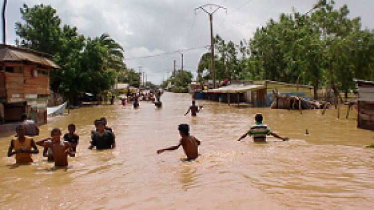
MapAction has deployed a team of two volunteers to Madagascar at the request of the United Nations to help coordinate the response to Cyclone Enawo which is reported to have already claimed at least five lives. It is thought to be the strongest cyclone in thirteen years with wind speeds of up to 185 mph (source: UNOCHA).
Cyclone Enawo made landfall over Antalaha district on 7 March and has continued its path across the country. The storm has caused widespread damage across north-eastern and central-eastern areas of the country, resulting in flooding, wind damage and landslides. The Malagasy Red Cross estimates that approximately 720,000 people will be directly or indirectly affected.
MapAction has deployed a team of two volunteers to the capital, Antananarivo, to help coordinate the response. A team previously deployed to Madagascar in response to floods caused by Tropical Storm Irina in 2012.
All maps and data that are produced in the field will be published in the maps and data page for Madagascar.

Value staying current with geomatics?
Stay on the map with our expertly curated newsletters.
We provide educational insights, industry updates, and inspiring stories to help you learn, grow, and reach your full potential in your field. Don't miss out - subscribe today and ensure you're always informed, educated, and inspired.
Choose your newsletter(s)


