PlanetObserver Releases New Version of Global Imagery Basemap
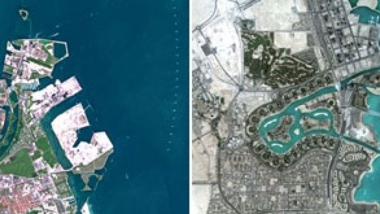
PlanetObserver, a provider of geospatial data for civil and military solutions, has launched one of the most up-to-date global mosaics processed with recent and cloud-free satellite imagery. With a 10-metre resolution at the global scale, PlanetSAT Global #2018 mosaic provides accurate geographic information for any part of the world. Users benefit from a seamless view of the Earth in high-quality natural colours, for an enhanced visual experience.
PlanetObserver has selected the best available multi-source data to process version #2018 of PlanetSAT Global mosaic. Very recent Sentinel-2 imagery at 10-metre resolution is used to update all large urban areas across the world and all capital cities. Continents are updated with new Landsat 8 imagery. All the imagery is colour-corrected, optimised and ready to use in different professional formats.
PlanetSAT Global #2018 mosaic will continue to bring great value to users across different industries. The mosaic is easy to use in many military, commercial and consumer applications for visualisation and simulation solutions, aircraft simulators, geointelligence solutions, web-mapping apps, to broadcast and weather graphics systems.
To find out more about PlanetSAT Global imagery basemap, visit the PlanetObserver website.

Value staying current with geomatics?
Stay on the map with our expertly curated newsletters.
We provide educational insights, industry updates, and inspiring stories to help you learn, grow, and reach your full potential in your field. Don't miss out - subscribe today and ensure you're always informed, educated, and inspired.
Choose your newsletter(s)


