Satellite Imagery Aids Rescue Efforts for Hurricanes
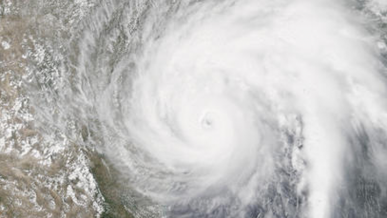
The calls for assistance started days before Hurricane Harvey came barreling across America’s doorstep this summer. First responders and government officials needed answers to prepare and protect communities. Remotely sensed imagery was provided—at no cost and almost daily—through the USGS Hazard Data Distribution System (HDDS) for analysis on the extent, severity and evolution of hurricanes Harvey, Irma and Maria.
How strong is this storm going to be? What kind of damage occurred on its path through the Caribbean? How might it impact southeast Texas once it makes landfall?
15,000 images were downloaded from HDDS following the three storms. Requests came from forty eight government agencies, including the U.S. Senate, Foreign Agricultural Service, Department of Homeland Security and the Centers for Disease Control and Prevention. As an example, Harvey dropped as much as 52 inches of rain in Houston, and the Federal Emergency Management Agency used data from HDDS to identify roads and other infrastructure that were under water in an effort to better direct rescue efforts.
Quick, easy and centralised access to high-quality imagery made it possible to create maps that were useful to disaster management authorities. HDDS is useful for numerous hazard situations in addition to hurricanes. For example, following the recent earthquake near Mexico City, imagery provided through HDDS allowed first responders to see collapsed buildings, blocked roads and damaged infrastructure. During fire season, HDDS makes it possible for first responders to have wide-scale pictures of situations.
HDDS acquires imagery and data from several sources, including the International Charter for Space and Major Disasters, of which the USGS is a member. Once the hurricane season blossomed, USGS EROS staff began pulling data acquired by space and aerial systems and loading them into HDDS.

Value staying current with geomatics?
Stay on the map with our expertly curated newsletters.
We provide educational insights, industry updates, and inspiring stories to help you learn, grow, and reach your full potential in your field. Don't miss out - subscribe today and ensure you're always informed, educated, and inspired.
Choose your newsletter(s)


