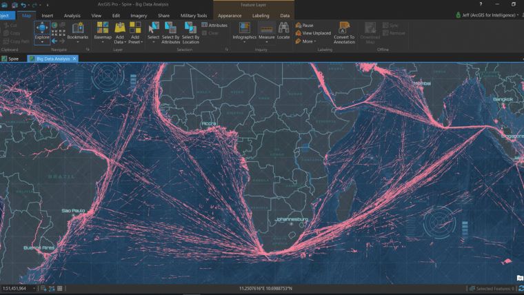
Spire Global Data Integrated with ArcGIS
Spire Global Inc. and Esri has announced the start of a new relationship that will enable Esri’s global user base across a broad range of industries to create even more powerful and effective products.
The relationship will see Spire Global participate as a Esri Partner Network. Esri Silver Partners are a select group and must demonstrate a commitment to help further develop and support the ArcGIS platform and the Esri user community at large. Spire’s unique datasets collected from its low earth orbit satellite constellation can now be easily integrated into the ArcGIS platform.
"With Spire's agile nano-satellite technology and infrastructure gathering data and the ArcGIS platform analysing it, we are making a powerful team for the benefit of the maritime industry and beyond." says Rafael Ponce, Maritime Consultant at Esri.

Value staying current with geomatics?
Stay on the map with our expertly curated newsletters.
We provide educational insights, industry updates, and inspiring stories to help you learn, grow, and reach your full potential in your field. Don't miss out - subscribe today and ensure you're always informed, educated, and inspired.
Choose your newsletter(s)


