Intergeo 2023: Berlin welcomes geospatial excellence
From 10 to 12 October, the vibrant capital city of Germany will be the epicentre of geoinformation innovation as it hosts Intergeo Expo and Conference. With a rich array of...

From 10 to 12 October, the vibrant capital city of Germany will be the epicentre of geoinformation innovation as it hosts Intergeo Expo and Conference. With a rich array of...
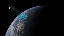
In a new partnership, Sanborn will use Pixxel’s hyperspectral dataset to equip its customers with advanced insights to solve problems as varied as agriculture crop and forestry health monitoring, exploration for...
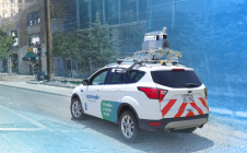
Cyclomedia has successfully completed data collection and delivery for the City of New Orleans, Louisiana, USA, following its victory in the RFP in November 2022. The official contract signing took...

The Mars Pro Laser RTK is the third addition to ComNav’s Universe series of GNSS receivers, following on from the Venus Laser RTK and Mars Laser RTK. According to ComNav...
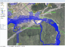
Nestled in the Hiroshima Prefecture of Japan, Higashihiroshima City has unveiled an advanced flood hazard and disaster prevention web GIS application. Powered by the TatukGIS developer kernel (DK) for ASP.NET,...

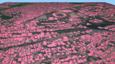
Pedro Pacheco is a GIS officer and drone pilot for The HALO Trust. Based in Angola, he concentrates on the use of drone surveys for non-technical survey support to aid...
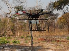
British mine-clearance charity The HALO Trust partnered with Routescene to undertake a UAV Lidar project in Cuito Cuanavale, in the Angolan province of Cuando Cubango. This case study demonstrates the...

GIS People has unveiled a new e-book resource designed to offer valuable insights into the world of GIS. The e-book is offered entirely free of charge as a means of fostering education...

The integration of geospatial information software (GIS), remote sensing and surveying and mapping data has accelerated in recent years. Meanwhile, new technologies such as AI models and ChatGPT are emerging...
Humanitarian organizations turned to artificial intelligence (AI) to generate a comprehensive map of sub-Saharan Africa at scale and also keep it updated to reflect real-world changes. Geospatial analysis is a...
This site uses cookies. By continuing to use this website, you agree to our Cookies Policy. Agree