Predicting the future by mapping the past
Lidar change detection (LCD) is one of the most capable techniques for mapping changing terrain through time. It can be applied in billion-dollar decisions to design, build and operate tunnels,...
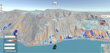
Lidar change detection (LCD) is one of the most capable techniques for mapping changing terrain through time. It can be applied in billion-dollar decisions to design, build and operate tunnels,...
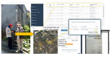
A mobile app has been developed to improve the success of cadastral survey implementation in Indonesia. The country has set itself ambitious land registration targets by 2025. The national cadastral...
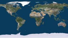
PlanetObserver and Kalisio have revealed My Planet Maps, a new subscription-based online map service that delivers immediate streaming access to fresh and global data. It includes performant vector and raster georeferenced basemaps....
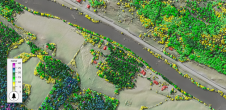
The technique known as structure from motion (SfM) has been suggested as a valid alternative to traditional photogrammetric methods. In a project in Glasgow, UK, an RTK-based point-to-point validation technique...
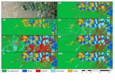
A recent study created crop type maps using Lidar, Sentinel-2 and aerial data along with several machine learning classification algorithms for differentiating four crop types in an intensively cultivated area....
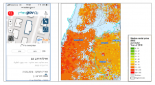
These five practical examples from Israel illustrate the role of governments, spatial data and technologies in developing a smart nation. The Fourth Industrial Revolution brings about new advancement and abilities...

Why are UAVs increasingly supplementing or even replacing terrestrial survey methods for many applications? This article explores the advantages of photogrammetric mapping with UAVs. Unmanned aerial vehicle (UAV or 'drone')...
Aerial images are great for interpreting tree species, but they don’t show tree heights and structure in the forest. Blom is a supplier in the Nordic market for capturing, processing...
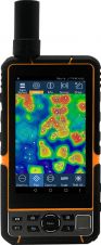
Elnav has launched its E-Tab series: industrial-level Android tablets with high-accuracy GNSS inside. The E-Tab series is designed for GIS professionals in the field and has advanced features for handheld,...
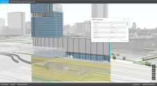
Interoperability is key in the building information modelling (BIM) context. Data diversity and interfaces, as well as possibilities for combining different data in BIM projects, are outlined in this article....
This site uses cookies. By continuing to use this website, you agree to our Cookies Policy. Agree