Satellite Imagery for Mapping
The ICA Commission on Mapping from Satellite Imagery is responsible for educating and informing the geospatial- data handling community about the link between the raw data captured from satellite imagery...
The ICA Commission on Mapping from Satellite Imagery is responsible for educating and informing the geospatial- data handling community about the link between the raw data captured from satellite imagery...
The European Space Agency and Astrium GmbH have signed a contract worth €263m to provide the EarthCARE satellite, the sixth Earth Explorer mission of ESA's Living Planet Programme. As prime...
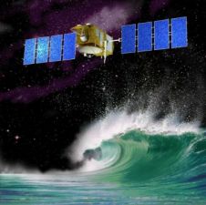
NOAA (Washington DC, USA) has announced the launch of a new satellite. The satellite will monitor the rate of sea-level rise and help measure the strength of hurricanes. NOAA will...

The European Space Agency and Astrium (Germany) today signed a €195 million contract to provide the first Sentinel-2 earth observation satellite, devoted to monitoring the land environment, as part of...
High-resolution satellite imagery (HRSI) has significant potential for producing 3D spatial information products. Nowhere is this more apparent than in remote areas of the world such as the small Himalayan...
The fourth in a series of eight modernized Global Positioning System (GPS) satellites that will deliver new capabilities to military and civilian users has been declared fully operational. Launched from...
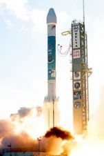
The fourth US Air Force modernized Global Positioning System Block IIR (GPS IIR-M) satellite was launched successfully from Cape Canaveral Air Force Station aboard a United Launch Alliance (ULA) Delta...
The emergence of new, low-cost, internet-based mapping tools like Google Earth, Google Maps, and NASA World Wind that make thousands of satellite images available to a wide audience has greatly...
Thailand's first geography-surveying satellite ''Theos'' is expected to be launched into orbit October 2007. The six-billion-baht satellite, officially called Thailand Earth Observation System (Theos), is being built by France-based Astrium...
In November last year China successfully put into orbit the third of its ZY-2 second transmitting-type remote sensing satellites. China launched the first and second ZY-2 satellites in September 2000...
This site uses cookies. By continuing to use this website, you agree to our Cookies Policy. Agree