Satellite Images Reveal Europe Is Facing Droughts
The past months have been the driest in the history of rainfall measurements in Europe, and satellite images reveal the scale of the problem. Recent storms, even the ones that...
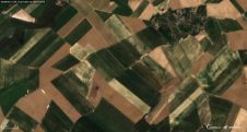
The past months have been the driest in the history of rainfall measurements in Europe, and satellite images reveal the scale of the problem. Recent storms, even the ones that...

The European GNSS Agency (GSA), in cooperation with the Ministry of Transport, organised the 'European GNSS Opportunities' workshop on 27 March 2013 at GSA’s headquarters in Prague, Czech Republic. Officials...
NASA and the Department of the Interior's U.S. Geological Survey (USGS) have released the first images from the Landsat Data Continuity Mission (LDCM) satellite, which was launched on 11 February...
Trimble has expanded coverage of its satellite-delivered Trimble RTX technology to most of the world. RTX technology enables Trimble xFill: a new technique in RTK and VRS surveying that allows...
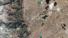
In the two years since DMCii added 22m multispectral imagery to its geospatial data portfolio, the detailed satellite views of the Earth's surface have proved to be useful tools for...
The 8th European Satellite Navigation Competition (ESNC) is to be launched during a kick-off conference on 10th and 11th May 2011. The event, hosted by the Institute of Engineering and...

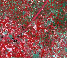
A meeting on the issues of application of space technology for monitoring and inventory of wild animals was held on 8th December, 2010 at ScanEx Research & Development Center. The...
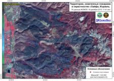
A satellite map of the Israeli disaster area was used by Emercom of Russia during their assistance in fire-fighting activities near Haifa city. Detailed imagery of IKONOS satellite from 4th...

Center of Space Monitoring of the Arctic Region was opened on 18th November at the Institute of the Information & Space Technologies of the Northern Arctic Federal University. The backbone...
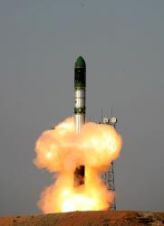
The TanDEM-X radar satellite designed and built by Astrium (Germany) was successfully launched early this morning. At 04:14 hours CEST (08:14 hours local time), a Russian Dnepr launch vehicle carrying...
This site uses cookies. By continuing to use this website, you agree to our Cookies Policy. Agree