Significant leap forward for UAV-Lidar mapping
DJI selected Intergeo in Berlin as the stage for unveiling the DJI Zenmuse L2. This highly integrated Lidar system builds on the success of DJI’s Zenmuse L1 to bring new...
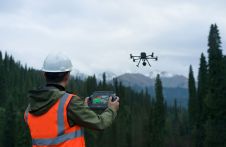
DJI selected Intergeo in Berlin as the stage for unveiling the DJI Zenmuse L2. This highly integrated Lidar system builds on the success of DJI’s Zenmuse L1 to bring new...
Lidar developer and manufacturer YellowScan and drone manufacturer DeltaQuad have announced a renewed partnership aimed at delivering high-quality 3D mapping data to professionals worldwide. The collaboration involves the integration of...

The curtains have fallen on Intergeo 2023. What were the key takeaways from the vibrant three-day event in Berlin? From 10-12 October, a diverse array of experts and enthusiasts from...
A global audience of geospatial professionals witnessed the presentation of the JOUAV VTOL Hangar, a groundbreaking development in the field of vertical take-off and landing (VTOL) drones, at Intergeo 2023....

Commercial UAV Expo, presented by Commercial UAV News, is the leading international trade show and conference focusing on the integration and operation of commercial UAS in select vertical markets. 206...

From 10 to 12 October, the vibrant capital city of Germany will be the epicentre of geoinformation innovation as it hosts Intergeo Expo and Conference. With a rich array of...
In this exclusive interview, two of the driving forces behind this year's Intergeo talk about the event's evolution and impact, nurturing talent, land surveying, Earth observation and the Blue Economy....
The Leica BLK2FLY is now able to scan indoors, providing expanded coverage for complex scanning projects. According to Leica Geosystems, part of Hexagon, the BLK2FLY now unlocks a new level...
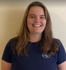
Katherine James, a remote sensing specialist at The HALO Trust, is specialized in the use of UAVs for assisting in the removal of landmines and other unexploded ordnance in countries...
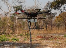
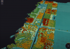
British mine-clearance charity The HALO Trust partnered with Routescene to undertake a UAV Lidar project in Cuito Cuanavale, in the Angolan province of Cuando Cubango. This case study demonstrates the...
This site uses cookies. By continuing to use this website, you agree to our Cookies Policy. Agree