China UAV Summit
Commercial UAV Expo is a conference and exhibition exclusively focused on the commercial sUAS (small Unmanned Aerial Systems) market in North America for: Surveying & Mapping Civil Infrastructure Process, Power &...
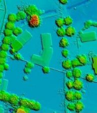
Topodrone, a Swiss-based designer and manufacturer of high-precision Lidar equipment for installation on drones, vehicles and backpacks, has launched Aquamapper, a UAV-based solution for bathymetric surveying and marine construction. The...
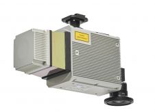
Teledyne Geospatial has introduced the Optech CLS-A, a new survey-grade UAV Lidar and camera system. The Optech CLS-A is developed for high-quality surveying and inspection applications where the tight integration...
SimActive, the Canadian developer of photogrammetry software, has launched a new UAV version of its Correlator3D product. This UAV version supports all non-metric small-format sensors. As an official sponsor of...
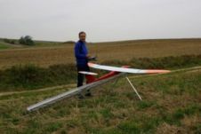
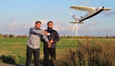
The AviSystem UAV was made on the assumption that it was intended to be a photogrammetric system. Hence, when designing the AVI, it was created for long, stable, precise and...
The Australian company Position Partners has announced an Unmanned Aerial Vehicle (UAV) for the Australasian civil construction, photogrammetry, mining and agricultural industry: SIRIUS UAV by MAVinci. Designed for a wide...
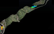
CATUAV, Spain, has developed an electric version of the ARGOS UAV platform designed specifically to meet the demands of CSIC's MESTRAL project. This new platform will enable images to be...
This site uses cookies. By continuing to use this website, you agree to our Cookies Policy. Agree