EvoLogics GmbH
EvoLogics is a high-tech enterprise with headquarters in Berlin, Germany, and a US sales office in Yorktown, Virginia. The company launched in 2000 with a strong group of scientists and...

EvoLogics is a high-tech enterprise with headquarters in Berlin, Germany, and a US sales office in Yorktown, Virginia. The company launched in 2000 with a strong group of scientists and...

Presagis has partnered with Airbus Defence and Space to give Presagis customers direct access to the OneAtlas satellite image library from inside its Velocity 5D (V5D) digital twin production platform....
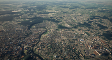
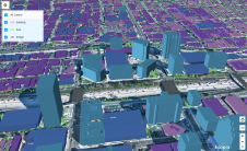
A national mapping agency in Europe needed to create a 3D digital twin of its entire country from a collection of geospatial data in varying scales and formats. A primary...
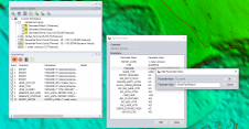
Established as an advanced and comprehensive geospatial software, Global Mapper Pro excels in terrain analysis, point cloud editing, drone-collected image processing and much more. Recent versions of the programme have...
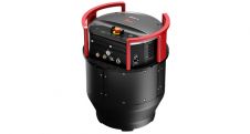
Leica Geosystems, part of Hexagon, has launched the Leica DMC-4, a highly efficient airborne imaging sensor providing unsurpassed image quality for various applications and complex mapping environments. With the new...
MariaDB has acquired CubeWerx, a leader in geospatial solutions, for an undisclosed amount. With this acquisition, MariaDB adds cloud-native, scalable geospatial capabilities that the company plans to offer through its...

Capturing and measuring the environment in the Arctic and Antarctic is a particularly challenging job. The area of interest is often covered by a thick blanket of snow and ice,...
Ecopia AI has entered a CAD8 million dollar funding partnership with Sustainable Development Technology Canada, which will support the creation of high-precision 3D vector maps across the top 100 cities...
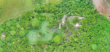
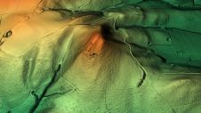
While it is possible to capture ancient Maya sites hidden beneath jungle canopy in remote locations using airborne Lidar, identifying them is still a time-consuming process. Typically, 3D point clouds...
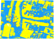
As a division of machine learning, deep learning (DL) has been achieving unparalleled success in image processing and recently demonstrated huge potential for point cloud analysis. Precise ground surface topography...
This site uses cookies. By continuing to use this website, you agree to our Cookies Policy. Agree