Luc Groot
Luc Groot is a regional manager at Kadaster International. After studying International Relations at the University of Groningen, he worked as a policy advisor in the European Parliament and as...

Luc Groot is a regional manager at Kadaster International. After studying International Relations at the University of Groningen, he worked as a policy advisor in the European Parliament and as...
A new and ambitious startup called NUVIEW entered the geospatial satellite industry in May 2023, following a lengthy period in ‘stealth mode’. In this exclusive interview with GIM International, the...
Our fast-changing world demands aerial cameras that are more productive, versatile and cost effective. The WARP Omni convertible camera is engineered to be highly competitive with satellite and UAV imaging, allowing you to leverage your expertise in aerial mapping for a broader range of applications. Our fast-changing world demands aerial cameras that are more productive, versatile and cost effective. The WARP Omni convertible camera is engineered to be highly competitive with satellite and UAV imaging,...
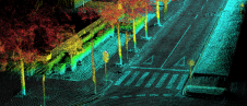
Ordnance Survey, the national mapping agency for Great Britain, was in need of a faster and more cost-effective way to collect georeferenced point cloud data, because the existing method was not sustainable in the long term. The Ordnance Survey team turned to Datron Technology and OxTS to help them develop a convenient, low-cost, ‘off-the-shelf’ mobile mapping system. Ordnance Survey, the national mapping agency for Great Britain, was in need of a faster and more cost-effective way to collect georeferenced point cloud data, because the existing method was...

Less than six months into her term of office, 'GIM International' spoke to Diane Dumashie, president of FIG (2023-2026), to hear about her experiences so far. Here, she shares her...
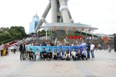
From 5-9 June, ComNav Technology's Annual Partner Conference 2023 took place in Shanghai, China. Some 30 global distributors from the UK, Japan, Australia, Guyana, Uganda and other countries gathered to...

To find out more about the geomatics education situation across the globe, 'GIM International' spoke to several industry experts from academia around the world. Are the numbers of students in...
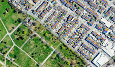
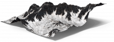
What are the primary technical differences between crewed and uncrewed aerial vehicles and satellites when it comes to capturing images of Earth? Where do they overlap, and where do they...
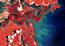
Planet Labs is acquiring Earth observation (EO) data platform Sinergise. The move is aimed at reducing the complexity of analysis and insights extraction as well as the cost of EO...
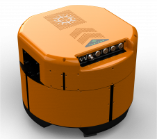
The Dutch startup Aerial Precision recently demonstrated its first two sensors with integrated artificial intelligence software. Over the past few years, the company’s innovation efforts have resulted in products that...
This site uses cookies. By continuing to use this website, you agree to our Cookies Policy. Agree