Found 11458 results
Sort by

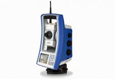
Portfolio of Optical Survey Solutions

Spectra Precision has introduced new additions to its Spectra Precision Focus line of optical survey solutions. With the new additions, survey and construction professionals have more positioning instrument choices to...

Read more

Earthquake and Tsunami Support

ESRI (CA, USA) and its international distributors are supporting response to the recent Indian Ocean earthquake and tsunami disaster by working with government agencies and disaster relief organisations to provide...

Read more

Monitoring Tsunami Disaster Areas

Space-based imagery is being used to assess disaster areas and direct relief efforts in areas hit by the tsunamis on 26th December 2004. Canada's RADARSAT-1 satellite previously acquired over 70...

Read more

Tsunami Disaster Mapping Portal

DM Solutions Group (Canada) and the University of Ottawa (Canada) have released a Tsunami Disaster Mapping Portal (DMapP). This interactive, internet-based infrastructure provides free access to current and historical spatial...

Read more

First Ever Tsunami Satellite Data

Unique, near real-time satellite radar altimeter data on the recent Tsunami in South East Asia was captured and processed by the Faculty Aerospace Engineering at Delft University of Technology in...

Read more

Airborne I Offers 3D LiDAR Tools

Airborne 1 Corporation (CA, USA) now distributes QT Modeler and QT Reader, two developments from John Hopkins University’s Applied Physics Lab (APL) that enable visualisation of high-resolution 3D LiDAR data....

Read more

Luxembourg Cadastral GeoPortal

IONIC (Belgium) is to build an intranet/internet geo-portal for the Luxembourg National Department of Cadastral Information (ACT-LUX). This portal will incorporate OGC standards, including a transactional Web Feature Service. Users...

Read more

New BAE Sales Director Americas

BAE Systems (CA, USA) has named Mark E. Sarojak sales director for the Americas, representing GXP, the company’s line of Geospatial eXploitation Products. Mr Sarojak will report to Dan London,...

Read more

VP Leica Geosystems GIS & Mapping

Leica Geosystems GIS & Mapping (GA, USA) has appointed Jim Farley vice-president business development. Mr Farley has spent more than twenty years in the information technology industry in both mainstream...

Read more

Trimble International User Conference

Trimble (CA, USA) will hold its International User Conference, ‘Trimble Dimensions 2005’, at the Mirage Hotel in Las Vegas from 23rd to 26th October 2005. The theme will be ‘Move...

Read more