Lidar in surveying & mapping
Lidar, short for Light Detection and Ranging surveying, represents a sophisticated measuring system leveraging the power of light. Widely recognized for its versatility, Lidar is extensively applied in diverse fields...
Lidar, short for Light Detection and Ranging surveying, represents a sophisticated measuring system leveraging the power of light. Widely recognized for its versatility, Lidar is extensively applied in diverse fields...
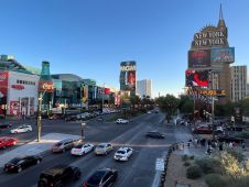
In the rapidly evolving landscape of geospatial technology, the annual Trimble Dimensions gathering is a dependable beacon for the surveying and mapping fields, providing a panoramic view of the current...

There are indications that today’s technological advances are putting a fully operational multipurpose cadastre within reach, following decades of a global vision and small-scale progress towards a comprehensive map-centric land...
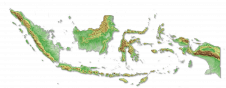
Intermap has won a US$20 million contract to map the Indonesian island of Sulawesi this year. The contract is the first phase of the Indonesian national topographic basemap programme to...
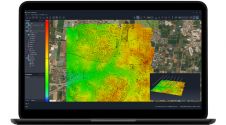
SimActive has unveiled the enhancement of Correlator3D for improved cloud environment productivity. With Correlator3D’s distributed processing capabilities, clients can seamlessly scale their processing in line with operational needs. The challenges...
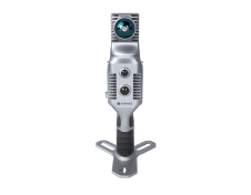
Stonex has launched a new SLAM solution for fast and efficient large-area surveys: the X70GO SLAM laser scanner. It combines mobile scanning with a stationary mode to scan with higher...

Stonex is an Italian company, world leader in measurement and surveying. The head office is near Milan and the American headquarters is in Concord, USA. The company also has a...

Founded in 2017, ZZCOMM technology of geospatial hardware and software solutions provides rapid and high-accurate geospatial data for BIM, mining AEC, survey and mapping industries, whether they are indoor, outdoor,...
In this exclusive interview, two of the driving forces behind this year's Intergeo talk about the event's evolution and impact, nurturing talent, land surveying, Earth observation and the Blue Economy....

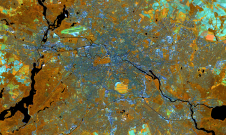
Intergeo 2023 was an electrifying three-day event in Berlin, transforming the city into the global geospatial capital. From 10-12 October, professionals from across the globe convened for the world’s premier...
This site uses cookies. By continuing to use this website, you agree to our Cookies Policy. Agree