Terrestrial Laser Scanning User Meeting
Optech is to organise its fifth International Terrestrial Laser Scanning User Meeting on 8th and 9th June 2010 in Prague, Czech Republic. Optech clients and expert users of static and...
Optech is to organise its fifth International Terrestrial Laser Scanning User Meeting on 8th and 9th June 2010 in Prague, Czech Republic. Optech clients and expert users of static and...
Last month we reported back from the Intergeo trade show that it was all about three abbreviations: Airborne Laser Scanning (ALS), Terrestrial Laser Scanning (TLS) and Mobile Laser Scanning (MLS)....
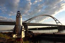
State-of-the-art geodetic and remote sensing techniques can prove their potential through particular engineering applications. Here we discuss load test measurements of bridges over the Danube. Prior to the particular bridge...
3D Laser Mapping (United Kingdom) has supplied a high performance laser scanning system to assist with a European research project to map the footprints of dinosaurs. The project, jointly undertaken...
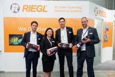
RIEGL has recently added the VUX-18024, a lightweight and versatile UAV-Lidar sensor for high-speed surveying missions, to its portfolio. This once again underlines the Austrian company’s pioneering role as a...
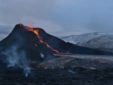
The Icelandic authorities have commissioned Acecore to map the extent and aftermath of the Eldvörp-Svartsengi volcanic system eruption using its high-end drone solutions. Grindavík, a fishing village on the Reykjanes...
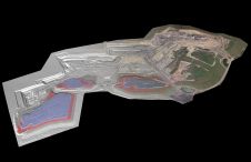
At Geo Week 2024 in Denver, Maptek unveiled its latest innovation: Maptek GeoSpatial Manager. This groundbreaking solution simplifies and streamlines workflows, revolutionizing how mining and civil engineering projects manage data...
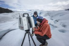
Technological advancements have brought increasingly compact instruments, enabling more rapid data acquisition and powerful processing abilities even in extreme field environments like glaciers, according to Tommaso Santagata, surveyor and speleologist from VIGEA – Virtual Geographic Agency and part of the Patagonia team. “Look deep into nature, and then you will understand everything better,” Albert Einstein is quoted as saying. And indeed, looking deep into glaciers can help us understand climate change. But...
Lidar, short for Light Detection and Ranging surveying, represents a sophisticated measuring system leveraging the power of light. Widely recognized for its versatility, Lidar is extensively applied in diverse fields...
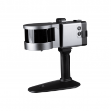
ComNav has announced the launch of its latest innovation: the LS300 3D laser scanner. This addition to the company's product lineup signifies a significant leap forward in addressing the dynamic...
This site uses cookies. By continuing to use this website, you agree to our Cookies Policy. Agree