Looking back on Intergeo 2023: mapping success in Berlin
The curtains have fallen on Intergeo 2023. What were the key takeaways from the vibrant three-day event in Berlin? From 10-12 October, a diverse array of experts and enthusiasts from...

The curtains have fallen on Intergeo 2023. What were the key takeaways from the vibrant three-day event in Berlin? From 10-12 October, a diverse array of experts and enthusiasts from...
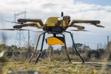
YellowScan, a familiar name in the mapping and land surveying realm, is making a noteworthy entrance in the hydrographic sector with the introduction of its pioneering UAV-based bathymetric Lidar solution....
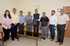
Trimble has announced a collaboration with the Indian Institute of Technology in Kanpur (IIT Kanpur) to support a new UAV programme offered by the Department of Aerospace Engineering. Trimble's contribution...

Daniel Asenso-Gyambibi is the director of the CSIR-BRRI, Ghana. His research areas are land administration, GIS and mapping. In his 23 years’ of professional experience, he has been involved in...
NV5 Geospatial's thermal infrared (TIR) solutions for transportation infrastructure challenges are currently being implemented in projects to analyse concrete bridges in the USA's Midwest. NV5 Geospatial, a leading geospatial data...
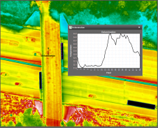
What are the challenges of image-based data acquisition for photogrammetric mapping and mesh modelling? And how can photogrammetry be made accessible? The annual Open Day Photogrammetry provided some answers to...
Lidar developer and manufacturer YellowScan and drone manufacturer DeltaQuad have announced a renewed partnership aimed at delivering high-quality 3D mapping data to professionals worldwide. The collaboration involves the integration of...
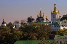
UNESCO organized an intensive training course for more than 20 cultural heritage professionals from eight regions of Ukraine threatened by increasingly frequent attacks, including the cities of Odesa, Kyiv and...

A man who received a 360-degree camera as a gift has taken it upon himself to incorporate his neighbourhood in Guernsey into the Google Street View online map, according to...
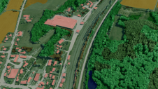
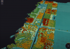
Innovative methodologies based on artificial intelligence (AI) are lowering the barriers and democratizing the use of 3D digital twins in the geospatial industry. Digital twins are revolutionizing the geospatial industry,...
This site uses cookies. By continuing to use this website, you agree to our Cookies Policy. Agree