Peak performance in mobile mapping
It can still be difficult to achieve centimetre-level accuracy in mobile mapping, especially in GNSS-denied or challenging areas such as in deep urban canyons, under foliage or through tunnels. However,...
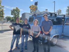
It can still be difficult to achieve centimetre-level accuracy in mobile mapping, especially in GNSS-denied or challenging areas such as in deep urban canyons, under foliage or through tunnels. However,...
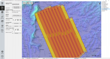
The TatukGIS Developer Kernel (DK) plays a key role in the Topoflight software suite (Missionplanner for optimal flight paths, and Navigator for precise data acquisition). In the realm of vast...

Recently unveiled by Vexcel Imaging, the groundbreaking UltraCam Dragon 4.1 represents one of the market's most advanced, progressively designed and seamlessly integrated hybrid aerial mapping systems. Tailored for high-resolution mapping...

The organizers of Geo Week have released a preview of two keynote sessions for 2024: 'The Bright Future Ahead: Navigating AEC, 3D, and Geospatial Innovation and Change', and 'Geospatial for...

From the skies to the ground, aerial surveying and mapping professionals play a crucial role in capturing, processing, analysing and publishing geospatial data. This article explores the diverse career opportunities...

From 10 to 12 October, the vibrant capital city of Germany will be the epicentre of geoinformation innovation as it hosts Intergeo Expo and Conference. With a rich array of...

Rapid advancements and improvements in technology have made a huge difference to surveying techniques and solutions. Such a densely populated market of devices can feel overwhelming, leaving buyers baffled as...

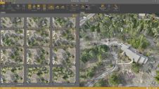
What are the challenges of image-based data acquisition for photogrammetric mapping and mesh modelling? And how can photogrammetry be made accessible? The annual Open Day Photogrammetry provided some answers to...
Virtual Surveyor has added drone photogrammetry capabilities to the latest release of its popular Virtual Surveyor smart drone surveying software. The new Terrain Creator app photogrammetrically processes drone photos to...
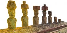
In this interview, John Ristevski, chairman and CEO of CyArk, takes us on the organization’s 20-year journey of digitally preserving cultural heritage sites. Today, the company uses advanced technologies such...
This site uses cookies. By continuing to use this website, you agree to our Cookies Policy. Agree