Found 4743 results
Sort by

Exploring the potential of videogrammetry

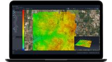
Videogrammetry can be seen as a natural progression from photogrammetry. So how can videogrammetry improve and enhance data collection for surveying professionals? This article explores its intricacies through case studies,...

Read more

PlanetObserver presents Global Basemap 2024

PlanetObserver has unveiled the PlanetSAT Global Basemap 2024, aiming to enhance geospatial data applications across various industries. The latest iteration of this renowned basemap provides users with up-to-date, cloud-free, and...

Read more

Pointorama

Are you facing challenges in managing, cleansing, editing, filtering, classifying, sharing or collaborating on your point clouds? Discover Pointorama to move your point clouds to the next level! Pointorama is more than just a point cloud platform. It is a catalyst for innovation, efficiency and collaboration. Take your point cloud projects to new heights with our cutting-edge technology....

Read more

SimActive announces upgraded cloud capabilities

SimActive has unveiled the enhancement of Correlator3D for improved cloud environment productivity. With Correlator3D’s distributed processing capabilities, clients can seamlessly scale their processing in line with operational needs. The challenges...

Read more

Rethinking service in the surveying industry

Looking for a recipe for business success in surveying? Don't underestimate the importance of innovative surveying services, says Moritz Lauwiner. The latest measurement sensors and software, decades of collective experience...

Read more