Transformative trends in laser scanning
In this Q&A, we asked Trimble’s Jeff Turgeon to share his insights into the current state of the sector and his expectations for the future. Looking at terrestrial laser scanners,...

In this Q&A, we asked Trimble’s Jeff Turgeon to share his insights into the current state of the sector and his expectations for the future. Looking at terrestrial laser scanners,...

The Open Geospatial Consortium (OGC) membership seeks to form a new Land Administration Domain Model (LADM) Standards Working Group (SWG). Public comment is sought on its draft Charter. Comments are...
Cyberhawk has entered into a global partner agreement with Phase One. Together, they will deliver the utmost standard of industrial inspections to the most discerning customers, leveraging the advanced capabilities...
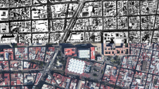
Over the past 15 years, geospatial information has enabled the transformation of towns, cities and a whole state in Mexico. The customer and data provider teamed up to create up-to-date...
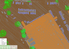
Blue Marble Geographic’s flagship software, Global Mapper Pro, is an all-in-one GIS package for analysing and processing vector, terrain, image and point cloud data. Compatible with over 380 different file...
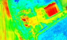
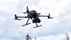
Topodrone has recently unveiled a cutting-edge drone thermal mapping solution: the Topodrone PT61 camera, designed to conduct detailed surveys and generate thermal orthomosaic maps, facilitating the creation of accurate 3D...

Kristen Maglia is senior product marketing manager at Esri. She started her marketing career in imagery analysis software immediately after graduating from Colorado State University, and has had the unique...

Both vertical and oblique aerial images have their own advantages, making them valuable in different reality mapping applications. So how can you choose between the two? This comparison will help...
It can still be difficult to achieve centimetre-level accuracy in mobile mapping, especially in GNSS-denied or challenging areas such as in deep urban canyons, under foliage or through tunnels. However,...
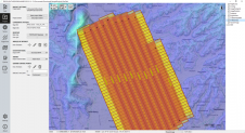
The TatukGIS Developer Kernel (DK) plays a key role in the Topoflight software suite (Missionplanner for optimal flight paths, and Navigator for precise data acquisition). In the realm of vast...
This site uses cookies. By continuing to use this website, you agree to our Cookies Policy. Agree