Ordnance Survey Data Gives Reality to a Virtual World
The spectacular setting of Ben Nevis provides the backdrop for an Oculus Rift game created by Ordnance Survey (OS) developers, in which players race against the clock to find a hidden...
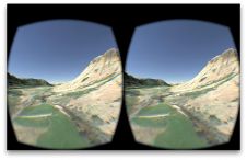
The spectacular setting of Ben Nevis provides the backdrop for an Oculus Rift game created by Ordnance Survey (OS) developers, in which players race against the clock to find a hidden...
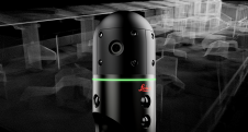
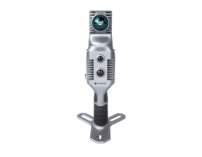
Leica Geosystems, part of Hexagon, has officially announced the Leica BLK2GO PULSE. This innovative first-person laser scanner merges state-of-the-art Lidar sensor technology with the iconic Leica BLK2GO design, representing a...
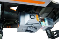
The AlphaUni 20 (AU20) Lidar system represents a new era in cost-effective, multi-platform mobile mapping solutions, according to CHC Navigation (CHCNav), a global leader in precision mapping, positioning and navigation...

There are indications that today’s technological advances are putting a fully operational multipurpose cadastre within reach, following decades of a global vision and small-scale progress towards a comprehensive map-centric land...

Linda Foster oversees Esri’s worldwide strategic vision for land administration and surveying. With 20 years of experience working in the land and resource industry, she is a registered professional land...
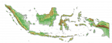
Intermap has won a US$20 million contract to map the Indonesian island of Sulawesi this year. The contract is the first phase of the Indonesian national topographic basemap programme to...
Stonex has launched a new SLAM solution for fast and efficient large-area surveys: the X70GO SLAM laser scanner. It combines mobile scanning with a stationary mode to scan with higher...
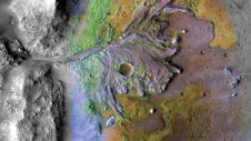
Using ground-penetrating radar, NASA’s Perseverance rover has uncovered compelling evidence of ancient lake sediment on Mars. This confirms the longstanding hypothesis that the Red Planet was once a warm, wet...

Global reference systems such as the International Terrestrial Reference Frame provide the foundation for determining positions on Earth and in space, as well as for reliably quantifying our planet’s changes...

Lidaretto is flexible and compact Lidar scanning system developed since 2015 and uniquely designed to be used the way that fits best to users’ specific application. You can easily mount...
This site uses cookies. By continuing to use this website, you agree to our Cookies Policy. Agree