BetterGIS Launches UVARA Platform to Manage Utility and Facility Infrastructure
BetterGIS, formerly known as UndergroundGIS, has announced the nationwide availability of an enhanced platform that offers greater capabilities to manage utility and facility infrastructure.
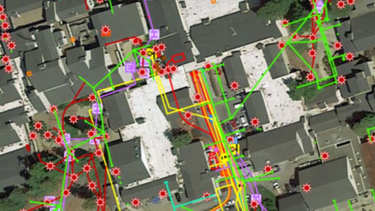
The expanded features in UVARA, the cloud-based solution, provides owners, operators and third-parties with a streamlined, simplified GIS that maps a wide range of underground, surface and above ground assets, including pipes, lines, conduits, and structures.
In conjunction with the nationwide launch of UVARA and its corporate rebranding, BetterGIS also announced a special partner program for architects, engineers and contractors.
BetterGIS CEO, Michael London, said “Our new company name better reflects the expanded value proposition to all those assigned the complex task of managing utility and facilities infrastructure. UVARA’s powerful visualisation, analytics and archival technology addresses the $1 trillion challenge of managing aging infrastructure and the costly, unforeseen problems that arise when there is no visual understanding of where assets are located.”
With implementations at 20 facilities in California, UVARA has mapped more than 25,000 structures, $200 million in replacement cost value and almost 3 million linear feet of assets.
Charlie Rudkin, Chief Operating Officer, said “UVARA promotes collaboration throughout the lifecycle of the asset with your entire team, including capital and master planners, architects, engineers, construction teams, facilities operations and maintenance teams, and public safety and disaster preparedness professionals.”
UVARA supports teams managing educational facilities, healthcare facilities, commercial real estate, utilities, and municipalities managing public works, storm sewer systems, and parks.
UVARA delivers the following benefits:
- Better forecasting and budgeting
- Better design and construction
- Better coordination among construction teams
- Fewer trips to the plan room
- Identify high-risk information gaps
- Continuously refreshed maps and data
- Preserve institutional knowledge
- Better risk management
For more details visit https://bettergis.com/

Value staying current with geomatics?
Stay on the map with our expertly curated newsletters.
We provide educational insights, industry updates, and inspiring stories to help you learn, grow, and reach your full potential in your field. Don't miss out - subscribe today and ensure you're always informed, educated, and inspired.
Choose your newsletter(s)


