Intergeo 2023 unleashed geospatial innovation and connectivity in Berlin
Intergeo 2023 was an electrifying three-day event in Berlin, transforming the city into the global geospatial capital. From 10-12 October, professionals from across the globe convened for the world’s premier international trade fair dedicated to geodesy, geoinformation and land management. This edition exuded a sense of pre-COVID enthusiasm, characterized not only by the substantial turnout of visitors but also by the palpable excitement generated through numerous product launches and updates that showcased significant technical advancements in the field.
Intergeo, as the industry’s leading event, serves as the hub that unites the geospatial community, forging connections between professionals across various sectors. This year’s Intergeo achieved a staggering attendance of nearly 17,000 trade visitors from 112 different nations, who descended on Berlin to explore the offerings from 571 exhibitors representing over 40 countries. Additionally, the conference hosted over 300 speakers and 841 attendees from 42 nations, reaffirming Intergeo’s stature as the preeminent trade fair and international congress platform for all facets of geodesy, geoinformation and land management.
Prof Dr Rudolf Staiger, president of the German Association for Geodesy, Geoinformation and Land Management (DVW), expressed satisfaction with the event’s resonance, stating: “The response of the exhibiting companies and the visitors at the exhibition, and the feedback from the conference participants, confirm our concept. We have positioned strong themes such as Earth observation and environmental monitoring, smart city, building information modelling (BIM) for infrastructure, digital twins, maritime solutions, 4D geodata and 3D cadastre. These are all elements of geospatial data-driven solutions for sustainable development. With this focus, we have struck a nerve.”
Earth observation and GIS
It was undeniably clear at Intergeo 2023 that global Earth observation technologies, including Copernicus and Galileo, play a vital role in informing localized decision-making on issues such as climate change, poverty alleviation, clean energy and sustainable urban development. The event underscored the significance of global monitoring and Earth observation in providing foundational insights necessary for understanding complex interconnections in a world facing the urgency of climate change and other crises. Precise spatial information is indispensable for individuals making crucial local decisions, and geospatial industry practitioners stand ready to provide this critical data.
Jack Dangermond, founder and CEO of GIS software group Esri, highlighted the importance of GIS in charting a sustainable future. He emphasized the role of shared geographic knowledge in addressing contemporary challenges, saying: “Sustainability begins with geography because it provides a deep understanding of holistic events. GIS as the foundation for digital twins enables us to understand impacts, model scenarios and derive necessary decisions. We must act because we are living beyond our means. Geospatial data is the foundation for generations to come.”

Industry’s toolkit
Moreover, Intergeo 2023 firmly established itself as the primary marketplace and pivotal meeting place for the geospatial community. The event showcased the industry’s toolkit of innovations – including cloud technologies, artificial intelligence, digital twins, BIM, uncrewed aerial vehicles (UAVs or ‘drones’), GIS, big data and more – that offers remarkable possibilities to be extended to users in diverse sectors.
In terms of innovative product launches, DJI unveiled the Zenmuse L2, a high-precision aerial Lidar system with a 4/3 CMOS RGB camera enhancing data collection accuracy for drones. IGI introduced the EcoMapper, a five-band aerial camera system with thermal imaging capabilities, and Vexcel showcased the UltraCam Dragon 4.1 hybrid oblique imaging aerial mapping system known for its precise elevation data and high-accuracy imaging. RIEGL presented a range of products, including the VQX-2 helicopter pod and the VUX-180-24, ideal for high-speed surveying missions.
Hexagon/Leica introduced the groundbreaking BLK2GO PULSE, a first-person laser scanner reshaping reality capture, and JOUAV presented the VTOL Hangar, promising precision and efficiency across various industries. Exail showcased the Atlans 3, a cost-effective inertial navigation system (INS) dedicated to land and air mobile mapping applications.
New aerial mapping solutions, such as the Ecomapper from IGI and Sony’s integration of the new ILX-LR1 oblique camera into its flagship surveying drone, garnered attention. Several new applications attracted interest for use in transport and industrial applications, including Prevu3D for creating digital twins and positioning solutions that go broader than surveying. Needless to say, this is just a small selection of the many impressive innovations to be discovered at this edition of Intergeo.
Sustainability through geodata
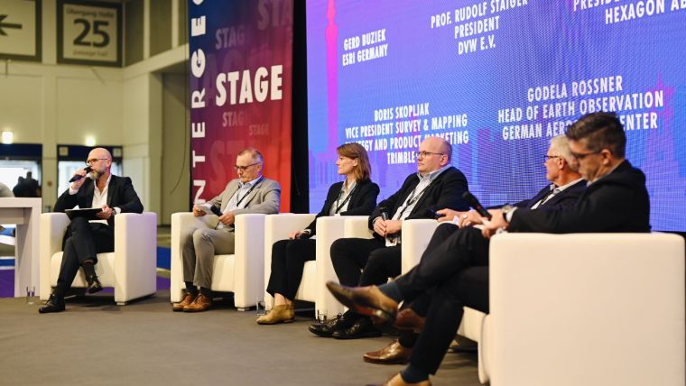
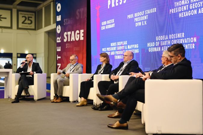
During the traditional annual press conference at lunchtime on the Wednesday of the event, there was a notable focus on sustainability through geospatial data. The fact that many construction companies are now adopting autonomous solutions, for instance, suggests a move towards more sustainable practices. However, there was some debate about whether enough attention is being paid to ways in which the geospatial sector can further improve its contribution to sustainability. Boris Skopjlak of Trimble argued that, given the abundance of environmentally friendly tech solutions, our industry should facilitate broader access for scientists, archaeologists, ecologists and others to harness our data. The key message to the business community was clear: let’s prioritize education and commitment!
Next-generation surveyors
The integrated side event called BIM-Days Germany highlighted the growing synergy between the geospatial industry and the digital construction industry. The 71st German Cartography Congress (DKK) was seamlessly integrated into Intergeo 2023, exploring topics such as generalization with machine learning and artificial intelligence, maps tailored for mobile use, and hazard mapping.
Rooted in engineering sciences, the fields of geodesy, geoinformation and land management are committed to nurturing young talent and specialists. DVW eV launched the Arbeitsplatz Erde platform to connect aspiring youngsters with the geospatial industry, supporting this with intensive promotional activities during the Intergeo Expo and Conference to inspire the next generation. The Geodesy Prize and Promotion Prize recognized outstanding final theses by students in the domains of geodesy, geoinformation and land management. Strikingly – and encouragingly – there seemed to be a large number of young visitors in attendance at this year’s event.
International growth
The event’s international growth was underlined by the heightened presence of international exhibitors and trade visitors, as well as the participation of the World Geospatial Council (WGIC), confirming the expanding international market presence. DVW President Staiger remarked on the significant increase in international participation at both the expo and the conference, highlighting the overwhelming response from exhibitors, visitors and conference attendees.
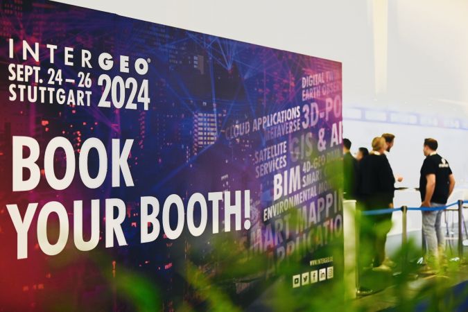
Looking to the future, many exhibitors have already secured their participation in the next edition of Intergeo, scheduled for 24-26 September 2024 in Stuttgart. The city’s reputation as a vibrant hub for international corporations and cutting-edge technology makes it an ideal host for the leading gathering of the worldwide geospatial community, shaping the future based on geoinformation-driven innovation in administration, business and science. And hopefully, besides from an international audience, next year’s event will also attract as much – and perhaps even more – attention from a young audience, as this would be very good news for the geospatial sector!

Value staying current with geomatics?
Stay on the map with our expertly curated newsletters.
We provide educational insights, industry updates, and inspiring stories to help you learn, grow, and reach your full potential in your field. Don't miss out - subscribe today and ensure you're always informed, educated, and inspired.
Choose your newsletter(s)


