Lantmäteriet digitizes Monrovia’s hand-drawn maps for the future
Can AI solve the puzzle of georeferencing title deeds?
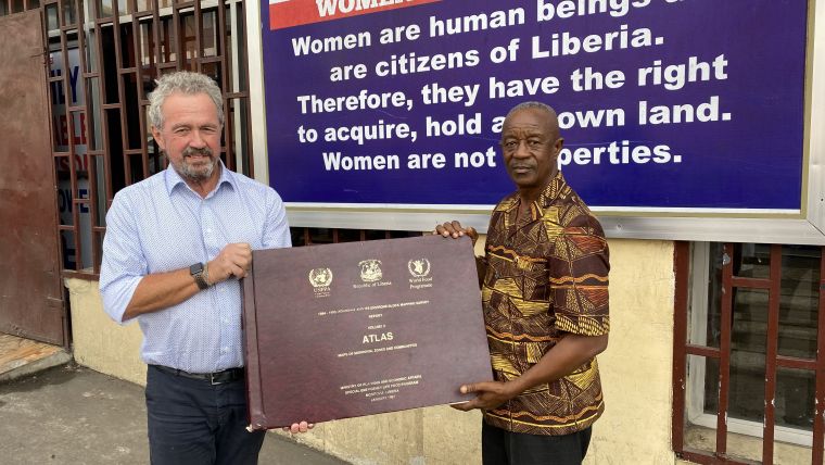
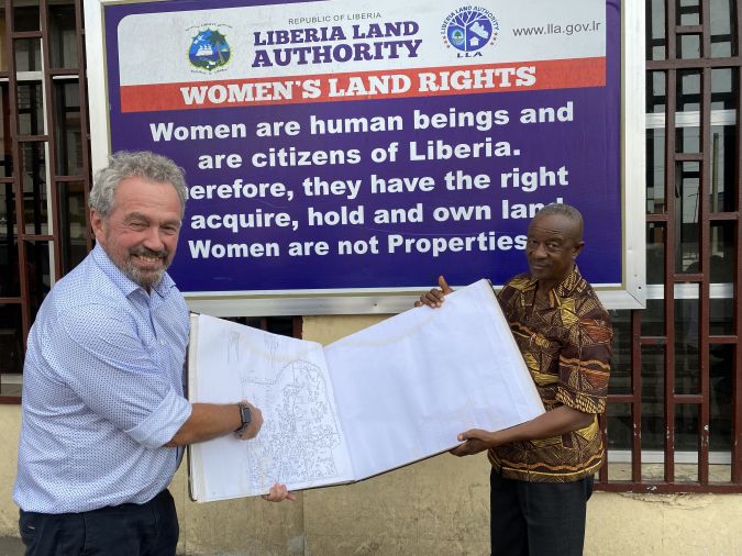
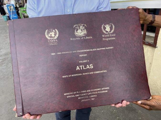
The discovery of an old atlas with hand-sketched maps of Liberia’s capital, Monrovia, could become the basis for a unique digital cadastre. Since Liberia is a country that largely lacks spatial information, whether as hard-copy maps, cadastral data or otherwise, the finding of the atlas is remarkable. With support from Lantmäteriet, it has now been scanned and therefore preserved for the future.
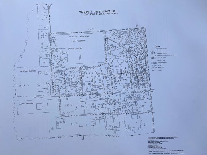
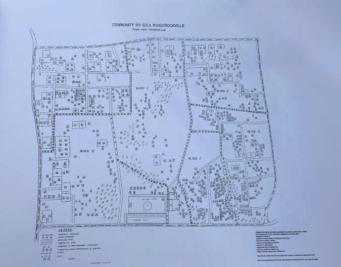
Lantmäteriet, the Swedish Mapping, Cadastral and Land Registration Authority, is implementing a Swedish-funded bilateral project with the Liberia Land Authority (LLA) called ‘Capacity Building for Inclusive Land Administration and Management Project in Liberia’ (ILAMP). This follows the discovery in late 2022 of an atlas that had been produced by the World Food Programme and UNFPA between 1994 and 1997, during a lull in the Liberian civil war. The atlas, which was found in a Liberia Land Authority office, is a hand-sketched block mapping survey of the Liberian capital city of Monrovia and its environs. The block mapping of the atlas is in 3D, given that apartments have also been captured along with all individual properties.
In conjunction with the atlas, two directories were discovered of principal occupants, commercial and private and public institutions that either owned or inhabited the properties at the time of mapping. The block mapping code implemented in the atlas links to the directories, associating the individual properties and apartments to the respective occupants (not necessarily owners) or institutions.
Spatial information lost due to civil war
This is a significant discovery, given that Liberia is a country that lacks spatial information, whether as hard-copy maps, cadastral data or otherwise. Much of the information has been lost due to the civil war. Therefore, after discussions with the management at LLA, the decision was made to scan the atlas and accompanying directories with the objective to subsequently digitize the atlas. Utilizing OCR, the digitized properties can then be linked to the records from the two directories as attribute data associated to the individual properties. This will hopefully result in the creation of a digital cadastral map of Monrovia as it was in 1997.
Scanning performed in Sweden
Scanning the atlas and directories in Liberia presented a challenge due to the unusual format of the material. The scanning was therefore done by experts at Riksarkivet (the National Archives) in Sweden. Riksarkivet possesses both the expertise and the technology to be able to scan books without having to remove the pages from the volumes. This has been particularly important since only a handful of hard-copy versions are in existence, as far as LLA is aware. The atlas was printed in Lebanon in 1997 and the company that arranged that task is still up and running in Monrovia today. Through this company, Christopher Byren (ILAMP project manager) and his colleague Maria Brander managed to get their own copy of the atlas and transport it – and the directories – to Sweden for scanning.
The historical significance of this work cannot be underestimated. The atlas and directories are now digitally preserved for the future and, more importantly, these hand-sketched maps could provide the basis for a digital cadastral map of Greater Monrovia that does not exist today.
Linking database records to title deed images
Additionally, there are plans to leverage technology to further refine the digitized map data. The scanning will create the basis for further work related to resurrecting the now-obsolete Open Title digital title deed solution.
Open Title, an International Land Systems, Inc. (ILS) solution, was previously deployed at the Liberian Centre for National Documentation, Records and Archives (CNDRA) in Monrovia. The Open Title system provided an indexed, searchable repository for digitized title deeds, but regrettably fell into obsolescence. Lantmäteriet was fortunately able to source the original Open Title database. Work is now ongoing to re-establish the links between the database records and scanned title deed images.
To date, corresponding image files for approximately 35% of the records in the database have been located. Further data extraction from the three original rack-mounted drives from CNDRA is planned, in addition to capturing approximately 39,000 scanned documents not yet registered in the database. Prominent features and ground control points in the digitized map data will also be surveyed to test the possible scale accuracy of the hand-drawn maps. Utilizing aerial imagery of Monrovia, it might be feasible to adjust and fit the map data to reality.
Next step is to use AI
The resurrection of what was Open Title, now installed at LLA, is being completed utilizing an alternative open-source database solution. Once the solution is as complete as possible in terms of matching historic database records with corresponding title deed image files, there will be the opportunity to cross-reference the database against the attribute data information from the digitized block mapping. This will hopefully make it possible to link some title deeds to properties, where the occupant at the time of the mapping was or might have been the property owner.
Additionally, given that historic title deed survey diagrams are captured as a bearing/distance between boundary points rather than being georeferenced, Lantmäteriet is investigating whether artificial intelligence (AI) might be leveraged to interpret survey diagrams, i.e. street names adjacent to properties, and to localize and georeference title deeds. The reconstituted digital title deed solution now also provides the ability to capture the geometry of new registered properties that are currently being surveyed with coordinates.
Capacity building
The work and effort by Lantmäteriet and LLA as described above forms only a part of the five-year ‘Capacity Building for Inclusive Land Administration and Management in Liberia’ (ILAMP) project. As the name implies, the focus is on building the capacity of the authority via knowledge and skills transfer. One example of the support provided to enhance local skills in the geospatial field is the financing of 20 surveying students currently completing their second or final year at the African Methodist Episcopal University in Monrovia. Training has also been provided on the latest survey methodologies, database administration and the workflow implemented to capture land parcels. Whilst this might be conceived as being rudimentary, substantial progress has already been made in building capacity at LLA, where equipment, systems and spatial data have previously been lacking.
Conclusion
ILAMP and Lantmäteriet were fortunate in discovering an old atlas with hand-drawn maps of Monrovia. Given the scarcity of spatial data in Liberia, Lantmäteriet saw the opportunity to create the foundation for a digital cadastre.
The first steps in the process have been completed with the scanning and digitization of the atlas and related directories. This work is not only invaluable in preserving a historic analogue cadastral map, but could also enable the georeferencing of digital title deeds from the resurrected alternative solution to what was Open Title. Much effort is still required in re-establishing and structuring cadastral information for Liberia, with the aim of creating a fit-for-purpose land administration system. It is hoped that leveraging AI will assist in finding the solution to this challenge.

Value staying current with geomatics?
Stay on the map with our expertly curated newsletters.
We provide educational insights, industry updates, and inspiring stories to help you learn, grow, and reach your full potential in your field. Don't miss out - subscribe today and ensure you're always informed, educated, and inspired.
Choose your newsletter(s)


