DatuSite Suite Released Online
Datumate has announced that its DatuSite suite, an aerial mapping and 3D modelling solution for field construction sites, will be offered at Datumate's online store.
DatuSite will be available for purchase worldwide beginning this week, with a range of monthly and annual subscription plans. The layered offering enables Datumate to provide its cutting-edge solution to a wide variety of customers, from individual surveyors to earth moving construction companies.
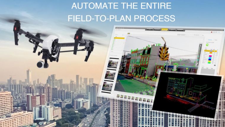
The solution utilizes drone images to generate maps as well as 2D and 3D models. It runs instant stockpile volume calculation, and generates construction monitoring reports that can be viewed on your desktop in less than an hour, all without the need of an Internet connection. The DatuSite platform. based on Datumate's powerful photogrammetry engine, features accurate, survey-grade measurement and stockpile volume calculations. Coupled with Datumate's DatuFly, an online application for automated flight planning and execution, solution becomes a valuable tool in the daily work that takes place at construction sites.
"In an increasingly digital world, Construction and Land Surveying professionals are becoming more comfortable with utilizing, for their daily tasks, fully automated solutions that are delivered as field analytics reports," stated Itay Segev, Datumate's VP Product and Strategy. "We are happy to be making this solution available online on a monthly and annual basis. Many of our new customers were asking for a simplified and timely business scheme for DatuSite and now they have it."
The key features of DatuSite include:
- Quick and automated process - from image taking to maps, models, and reports
- Measurements at pixel-level accuracy using New Points, Polylines, Polygons, Surfaces, and linear distances between points
- High-precision map generation, with maps at a scale of 1:250
- 3D texture models and true orthophoto generation; seamless export to CAD systems
- Generation of reports for stockpile and volume calculations
- Processing customer data on the customer's desktop (which is quicker and more secure)

Value staying current with geomatics?
Stay on the map with our expertly curated newsletters.
We provide educational insights, industry updates, and inspiring stories to help you learn, grow, and reach your full potential in your field. Don't miss out - subscribe today and ensure you're always informed, educated, and inspired.
Choose your newsletter(s)


