Multi-disciplinary Trend Detection, Analysis and Forecasting from Aerial Film Archives
April 15, 2022
Only a small fraction of the information content in aerial films has ever been recorded on paper maps, most of which are inaccessible. The use of artificial intelligence (AI) to fully automate the process of information extraction from imagery will soon unleash the true value of this information by enabling the creation of land cover maps of all the world’s countries stretching back to the 1930s.
From the 1930s to about the year 2000, much of the world was captured at regular intervals on high-resolution aerial film using aerial mapping and reconnaissance cameras, by national mapping organizations, defence organizations and private mapping companies. During that time, the Earth has been transformed by massive industrialization and urban growth. The Earth’s population increased threefold from two to six billion people, tens of millions of kilometres of roads were constructed, billions of houses were built, global GDP increased fourfold, and large areas of forest and grasslands were transformed into agricultural fields and towns.
These changes to the Earth are recorded on millions of rolls of aerial film that mostly lie locked way in archives and remain inaccessible. Unfortunately, due to past technical limitations and laborious manual feature extraction, only a small fraction of the information content in these films has ever been recorded on paper maps, and most of these are no longer accessible and not digitized. Many of the films are deteriorating, or even worse are being disposed of as the storage costs are considered too high. However, these films record the heritage of our changing world and are a highly valuable resource if they can be accessed.
Unleashing the true value
Until now, scanning the films was a very slow and expensive process. For most organizations, the majority of their archive is therefore still inaccessible, except for bespoke and costly scanning of individual frames. The true value of the archive is only achieved when the data becomes easily accessible as a complete digital archive. Once all the films are scanned and georeferenced, they can form temporal imagery layers that can be quickly viewed to identify changes and trends and to make predictions.
Traditionally, human operators were required to extract information such as the location of buildings, roads, tracks and boundaries. This was a very time-consuming and expensive exercise. Conventional data acquisition concentrated on collecting data as individual objects using a standardized mapping schema. Only specific objects were recorded based on whether they were of specific interest and were of a sufficiently large size. The environment at that time was widely ignored and poorly documented. It is estimated that only about 5% of the information in these films was ever extracted and a fraction of this remains in a digitally accessible form.
This has now all changed. It is now possible to use artificial intelligence (AI) to fully automate the process of information extraction from imagery. If a human operator can identify a feature, then AI can do so too as long as it is provided with sufficient training datasets. The deep learning models are advancing rapidly, and techniques such as transfer learning are significantly reducing the number of training datasets required.
In a similar way in which Esri, The Impact Observatory and Microsoft were able to generate 10m land cover maps of the entire world using recent multispectral Sentinel-2 images, it will soon also be possible to create similar land cover maps of each country of the world stretching back to the 1930s based on training and running AI on higher-resolution panchromatic and colour imagery. The spectral depth of the multi-spectral satellite imagery can be replaced with the context obtained from the higher-resolution stereo aerial imagery. The existing aerial photography was nearly all flown with 60/30 overlap, meaning that there are between three and nine separate views of each location. This independent measurement redundancy will further increase the obtainable accuracy.
Land cover maps
These land cover maps will provide real statistics on how the planet has changed. Moreover, creating multiple temporal data points will enable us to determine accurate trends in various domains and hence to better predict the consequences of future development measures. These data points in time can be correlated with other measurements to better understand the cause and effect that humans have on the environment, as well as the changes that must take place to avert a global environmental disaster.
Land cover maps also enable simple change detection and anomaly detection for the identification of features currently lost to more recent human development or natural erosion processes. Further, review of the imagery provides irrefutable evidence that is not available in older paper maps which are based on human interpretation and biases.
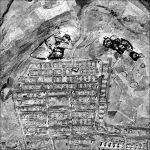
Sample selection of georeferenced multi-temporal aerial images of Dubai
A single image in time provides a snapshot of the world. That in itself is fascinating. We can identify things that have been lost in time and draw accurate conclusions on aspects such as property boundaries, forest extents, levels of infrastructure, and the location and structure of buildings that may no longer exist. A series of pixel-aligned georeferenced images tell an even greater story. The significance is created by the time-lapse effect, similar to a movie clip composed multiple of images, highlighting gradual movement and changes over time. Therefore, observing temporal orthoimages enables us to instantly identify objects that have changed or been displaced, even when in the displacement has been too slow to be noticed on site in real time. The time-lapse effect allows us to identify developments at an early stage, when we can still identify the cause and consequently have the opportunity to respond to the trend. Waldo Tobler’s first law of geography states that “Everything is related to everything else, but near things are more related than distant things”. The definition of “near” is not only spatial, but also applies to time. Everything affects everything: an axiom!
Satellite imagery improvements
Space-based imagery has been available since the 1970s. With the exception of the Corona Satellite photography imagery (about 1960-1970) that had approx. 3m resolution and was kept highly secret for about 30 years, the only wide-area satellite imagery coverage was from the Landsat programme which at that time had 60m resolution. Most aerial imagery between the 1930s and 2000 was captured at sub-metre resolution, and cities often at decimetre resolution.
The resolution of commercial satellite imagery has improved immensely since then. In 2000s, 1m resolution imagery became accessible, and today accurate global 1m resolution imagery is available along with accurate digital terrain models. The massive volumes of high-resolution satellite and digital aerial imagery is providing us with an accurate definition of our world today, but to really understand the trends we need to look back at the changes that have taken place over many decades. The availability of such accurate high-resolution basemap and digital terrain models greatly facilitates the georeferencing and orthorectification of the older aerial imagery to enable suitable simple comparisons.
Sample selection of georeferenced multi-temporal aerial images of Munich
Whereas storage costs were a challenge in the past, these have been superseded by massive increases in hard disk storage and relatively inexpensive cloud storage costs. A single 15um 8bit panchromatic image can be compressed from about 250MB to about 75MB with minimal quality loss. An aerial film archive of a thousand roles of aerial film will contain approximately a quarter of a million images and require about 18TB of storage, which nowadays would fit on a couple of hard disks or can easily be uploaded to cloud storage. Moreover, the computing cost for AI is low and so what was previously inconceivable is now quite possible.
GeoDyn is revolutionizing the accessibility of aerial film archives by developing highly advanced photogrammetric aerial film scanners capable of transforming these aerial films into quickly accessible, accurate digital images that maintain the full information content. With PromptSCAN, the conversion speed is now 50 times faster and a magnitude cheaper than was previously possible. In addition to scanning, GeoDyn also provides highly efficient workflows for accurately georeferencing these images to create temporal image maps and the extraction of information to enable the identification and quantification of change.
Treasure trove of information
Once accurately scanned and georeferenced, these digital images provide a treasure trove of valuable Information. They enable us to determine the ‘what, where and when’ of past events. Using new machine learning and data mining technologies, we can now trace how the Earth has transformed, categorize the kinds of changes that have taken place and help to predict future trends.
GeoDyn was founded by a team of photogrammetrists. The vision is to unlock the information recorded in aerial film archives around the world and convert it into temporally sequenced maps so that humanity can fully understand the Earth’s geopolitical, climatic and industrial development over time. Between them, GeoDyn’s employees have over 200 years of experience in the aerial survey industry. The company provides full-service aerial film conversion, georeferencing and information extraction. In addition to the development of high-speed aerial film scanners, GeoDyn has developed technologies that enable the rapid and accurate conversion, georeferencing, rectification and delivery of aerial imagery.
As an Esri Gold Level business partner, GeoDyn assures full integration with ArcGIS. All images become accessible as both temporal base maps and dynamic image services, enabling the full information content of the imagery to be accessed in a wide range of applications for visual interpretation, automated feature extraction using machine learning, and data analytics.
More info
A sample selection of georeferenced multi-temporal aerial images can be viewed at www.geodyn.com.
Value staying current with geomatics?
Stay on the map with our expertly curated newsletters.
We provide educational insights, industry updates, and inspiring stories to help you learn, grow, and reach your full potential in your field. Don't miss out - subscribe today and ensure you're always informed, educated, and inspired.
Download this article as a print friendly PDF and receive our weekly overview of the most important geomatics news and insightful articles and case studies.
Sharing this article
Ofcourse we encourage you to share this article with your peers if you enjoyed reading it. Copy the URL below or share it on your social media of choice.
This site uses cookies. By continuing to use this website, you agree to our Cookies Policy. Agree


