Planet was founded with the mission to image the Earth every day and make change visible, accessible, and actionable. Over the past decade with our customers, Planet has revolutionized the Earth observation industry, democratizing access to satellite data beyond the traditional agriculture and defense sectors.
To that end, Planet provides the leading web-geo platform with the highest frequency satellite data available and foundational analytics to derive insights, empowering users across the world to make impactful, timely decisions.
Businesses, governments, and research institutions leverage Planet’s data and platform to scale their operations, increase efficiency and mitigate risk, and develop novel solutions to address their most pressing challenges. This helps them stay ahead in ever-changing global contexts and ultimately capture unforeseen windows of opportunity.
Integration & Access
Planet takes a software platform approach to Earth observation, by providing user-friendly GIS integrations and imagery-hosting services — and modern APIs.
Whatever your needs, Planet makes it easy to integrate satellite imagery into your geospatial tools:
Tile services: Seamlessly stream OGC web services directly from Planet into your GIS applications.
API-first platform: Build custom integrations and data pipelines to power any earth observation solution built on ArcGIS.
GIS integrations: Simply search, access, and analyze the Planet catalog of daily, global imagery directly from ArcGIS Pro. Get started by downloading the QGIS plug-in or ArcGIS plugin now.
Drive richer analysis with high-spatial resolution and high-frequency data, broad-area coverage, and automated detection feeds – integrated directly into your geospatial platform. Learn more.
Sentinel Hub
Sentinel Hub is an advanced API-first Earth observation platform. Access Planet and public imagery directly from the cloud – without building your own imagery management infrastructure.
Cloud-hosted imagery platform: Access Planet and public imagery directly from the cloud — without building your own imagery management infrastructure.
Configurable analysis APIs: Create customized visualizations, spectral indices, and statistical calculations to extract insights from imagery in seconds.
Integrate into any workflow: Utilize serverless processing to integrate imagery into your custom application, data science workflow, or GIS through streaming APIs.
Imagery streaming: Access full spatial resolution, bit depth, and spectral bands over the web after you order imagery.
Get started with PlanetScope in Sentinel Hub, now with flexible packages and transparent pricing
Planet Products
Planet provides geospatial insights at the speed of change, equipping organizations with the data necessary to make informed, timely decisions.
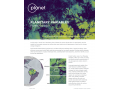
Planet Monitoring: With roughly 200 Dove CubeSat satellites in orbit, the PlanetScope constellation provides a continuous and complete view of the world from above. Leverage this global, daily dataset to see and understand daily changes on Earth.
Planet Basemaps: Power your applications and analytics with seamless Basemaps built from the most recent imagery over broad areas. With daily, global imaging, Planet selects the best pixels and transforms them into visually consistent and scientifically accurate mosaics that empower time-series analysis and machine learning-powered analytics.
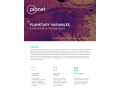
Planet Tasking: At 50 cm resolution, Planet Tasking provides organizations with real-time intelligence to proactively identify blind spots, anticipate events, and have confidence in the next mission-critical decision.
Planet Analytic Feeds: Planet Analytic Feeds leverages deep learning to identify objects and features of interest from Planet imagery at global scale, empowering you to prioritize resources and act with the most recent insights available.
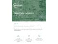
Planetary Variables: Data sources from across the electromagnetic spectrum, including optical, radar, passive microwave, and lidar sensors, reveal different aspects about Earth’s physical properties. By fusing these distinct sources together, Planetary Variables unlock actionable insights.