3DReshaper 2018 Released
3DReshaper 2018 has been officially released with lots of new features including a brand-new reporting engine allowing you to create, edit, and customise your own reports from pre-defined templates or from scratch.
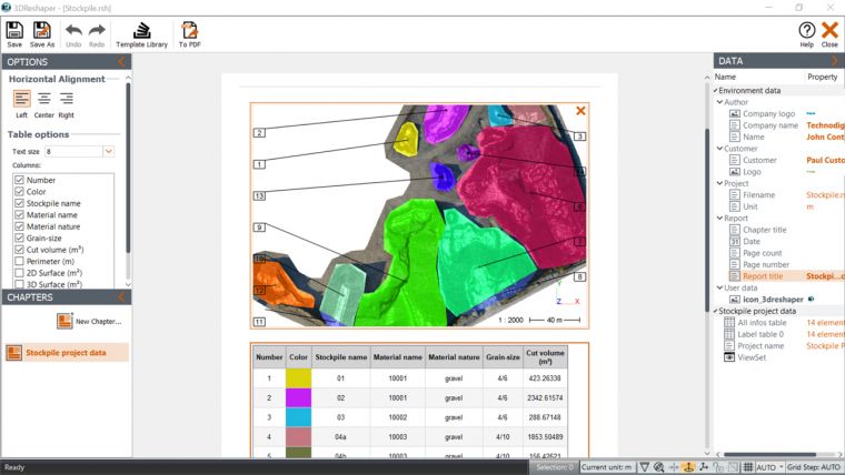
The release also includes a report editor that is a complete tool to end your workflows with. Add text, move images, put a snapshot of your scene with labels, data tables and export all of it in a 2D or 3D PDF.
3DReshaper 2018 allows you to work your point with even more precision than before with the clean/separate command which has been significantly improved for an easier and more efficient use; and you can now benefit from new segmentation and filtering tools (according to the point cloud’s real colours, its inspection or intensity values, etc.).
Aware of the surveyors’ constantly-evolving environment, the software allows you to address new markets: discover new tools for stockpile measurements (draw the contour directly on point clouds to measure its volume), and the possibility to compute a 2D inspection for road cross sections.
Download the new version here

Value staying current with geomatics?
Stay on the map with our expertly curated newsletters.
We provide educational insights, industry updates, and inspiring stories to help you learn, grow, and reach your full potential in your field. Don't miss out - subscribe today and ensure you're always informed, educated, and inspired.
Choose your newsletter(s)


