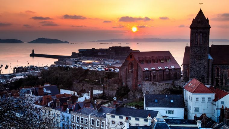
A mission to add Guernsey to Google Street View
A man who received a 360-degree camera as a gift has taken it upon himself to incorporate his neighbourhood in Guernsey into the Google Street View online map, according to a BBC report. Google’s own image collection activities were abandoned in 2011 after islanders raised concerns about privacy. Guernsey is one of the Channel Islands off the French coast of Normandy. Google Street View compiles images from various locations worldwide, enabling virtual exploration of interesting places.
Andre Quevatre has now initiated the process of capturing the Vale parish independently. Google permits individuals to upload images to Google Street View and employs artificial intelligence to blur faces and car registration plates as part of its service.
Significant attention
According to Guernsey’s Office of the Data Protection Authority (ODPA), Google deployed cars on the island for the Street View service in 2010. However, the company subsequently ceased operations due to concerns about the collection of Wi-Fi data on private roads, prompting intervention by the commissioner at that time. All of the company’s vehicles left Guernsey and did not return, despite not having completed the image collection project.
The ODPA clarified that the act of recording such images is not inherently unlawful, given the widespread use of mapping and imaging applications. However, compliance with the Data Protection (Bailiwick of Guernsey) Law 2017 is required when collecting and processing personal data.
After receiving a 360-degree camera for his birthday, Quevatre was inspired to undertake this project. He began by documenting his own street and then expanded the project to cover the entire Braye du Val and parts of L’Ancresse, expressing the benefits of Street View for tourism. Although there are a few lanes left to be done, he has already gained significant attention, with hundreds of thousands of people having viewed the content he has uploaded since August 2023.
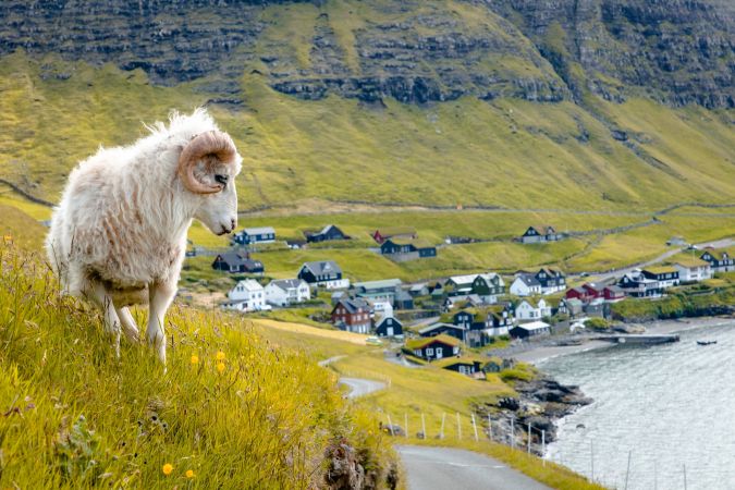
Mapping the Faroe Islands
The Faroe Islands archipelago is another location that had been notably absent from Street View. Realizing that Google had no immediate plans to map the Faroe Islands itself, a resourceful employee from the Visit Faroe Islands tourist board devised her own innovative solution: Sheep View 360.
This unconventional approach entailed equipping local shepherds’ sheep with cameras to capture their surroundings as they roamed freely. Given that the islands are home to more sheep than people, this inventive and straightforward mobile mapping strategy turned out to be a stroke of brilliance. Upon catching wind of the Sheep View 360 project, Google responded with enthusiasm, providing the Faroe Islands with a Street View Trekker and 360-degree cameras. This collaborative effort empowered both residents and tourists to act.
For the BBC article, see here.
An inspiring article on surveying the Faroe Islands can be found here.

Value staying current with geomatics?
Stay on the map with our expertly curated newsletters.
We provide educational insights, industry updates, and inspiring stories to help you learn, grow, and reach your full potential in your field. Don't miss out - subscribe today and ensure you're always informed, educated, and inspired.
Choose your newsletter(s)


