Digital Earth Australia Releases New Features for more Accessibility
Digital Earth Australia (DEA), an analysis platform that uses satellite data to detect physical changes across Australia in unprecedented detail, has recently introduced new features to ensure its high-quality data products are now even more accessible for individuals, industry and government.
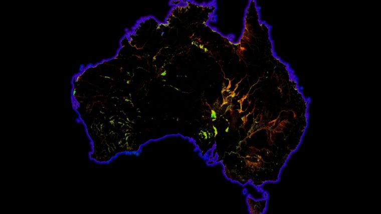
By combining historical data from the last 30 years with an ever-growing range of information from new satellites, DEA provides regular updates for the entire country via its NationalMap product. It can be used to identify soil and coastal erosion, crop growth, water quality and changes to cities and regions in greater detail and with more authority than previously thought possible.
This wealth of knowledge is invaluable for decision-making, from the government level right down to a single farmer looking for ways to innovate and expand their business.
Four new data products from DEA have now been released on NationalMap, a free access website for map-based access to spatial data from Australian government agencies. These products include Sentinel 2 data processed in near-real time, Mangrove Canopy Cover, the Surface Reflectance Geometric Median, and Water Observations from Space.
“These new products will improve how we use satellite data to detect physical changes across Australia in exceptional detail. Detecting these changes is important as it provides governments, industries and individuals with high-quality data and tools to make policy and investment decisions. We’ve already had farmers on the ground say they can use NationalMap to see the history of their land, so they can be better prepared for changes in climate and water availability, and government agencies have also been successful in tracking water released for the environment through river systems.” said Trent Kershaw, DEA’s Program Director.
Geoscience Australia is now working with FrontierSI to engage Australian businesses and demonstrate how they can use DEA to develop new commercial applications of its free-to-access data.

Value staying current with geomatics?
Stay on the map with our expertly curated newsletters.
We provide educational insights, industry updates, and inspiring stories to help you learn, grow, and reach your full potential in your field. Don't miss out - subscribe today and ensure you're always informed, educated, and inspired.
Choose your newsletter(s)


